Area Overview for KT6 6SH
Photos of KT6 6SH


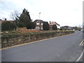

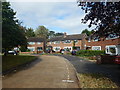
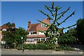

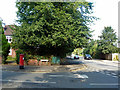
26 photos from this area
Area Information
Key information about the KT6 6SH including its size, population, and administrative classification.
- Area Type
- Postcode
- Area Size
- 7855 m²
- Population
- 1576
- Population Density
- 9488 people/km²
House Prices in KT6 6SH
30
Properties
£291,040
Average Sold Price
£137,000
Lowest Price
£490,000
Highest Price
Showing 30 properties
| Address | Type | Beds | Baths | Last Sale Price | Last Sale Date | |
|---|---|---|---|---|---|---|
| 14, Hollingsworth Court, Lovelace Gardens, Surbiton, KT6 6SH | Flat | 3 | 1 | £460,000 | Nov 2025 | |
| 6, Hollingsworth Court, Lovelace Gardens, Surbiton, KT6 6SH | Flat | 2 | - | £365,000 | Jul 2025 | |
| 29, Hollingsworth Court, Lovelace Gardens, Surbiton, KT6 6SH | Flat | 2 | 1 | £405,000 | Feb 2025 | |
| 17, Hollingsworth Court, Lovelace Gardens, Surbiton, KT6 6SH | Flat | - | - | £490,000 | Nov 2024 | |
| 1, Hollingsworth Court, Lovelace Gardens, Surbiton, KT6 6SH | Flat | 3 | 1 | £375,000 | Feb 2024 | |
| 25, Hollingsworth Court, Lovelace Gardens, Surbiton, KT6 6SH | Flat | - | - | £370,000 | Sep 2023 | |
| 12, Hollingsworth Court, Lovelace Gardens, Surbiton, KT6 6SH | Flat | 2 | 1 | £435,000 | Nov 2021 | |
| 28, Hollingsworth Court, Lovelace Gardens, Surbiton, KT6 6SH | Flat | 2 | 1 | £325,000 | Jun 2013 | |
| 26, Hollingsworth Court, Lovelace Gardens, Surbiton, KT6 6SH | Flat | - | - | £250,000 | Jan 2012 | |
| 21, Hollingsworth Court, Lovelace Gardens, Surbiton, KT6 6SH | Flat | - | - | £273,000 | Oct 2011 |
Page 1 of 3
Energy Efficiency in KT6 6SH
Amenities
Schools
| Rank | School | Type | Entry gender | Ages |
|---|
Explore more schools in this area
Go to Schools tabDemographics
Household Size
One person
most common
Accommodation Type
Flats
most common
Tenure
39
majority
Ethnic Group
White
most common
Religion
N/A
most common
Household Composition
N/A
most common
Age
47
median
Adults (30-64 years)
most common
Household Deprivation
N/A
with no deprivation
NS-SEC
56
in Lower managerial occupations
Explore more demographic insights in this area
Go to Demographics tabPlanning
Planning Constraints
- Flood RiskPremium
- Ramsar Wetland SitesPremium
- Area of Outstanding Natural BeautyPremium
- Protected Nature ReservePremium
- Protected WoodlandPremium