Area Overview for KT4 8XF
Photos of KT4 8XF

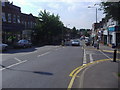
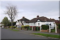
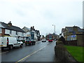
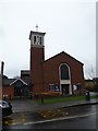
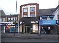
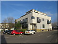
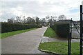
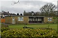
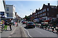
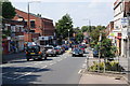
34 photos from this area
Area Information
Key information about the KT4 8XF including its size, population, and administrative classification.
- Area Type
- Postcode
- Area Size
- 2.2 hectares
- Population
- 1390
- Population Density
- 5361 people/km²
House Prices in KT4 8XF
33
Properties
£456,465
Average Sold Price
£105,000
Lowest Price
£782,500
Highest Price
Showing 33 properties
| Address | Type | Beds | Baths | Last Sale Price | Last Sale Date | |
|---|---|---|---|---|---|---|
| 104 Oaks Avenue, Worcester Park, KT4 8XF | house | - | - | £720,000 | Jun 2022 | |
| 78 Oaks Avenue, Worcester Park, KT4 8XF | house | - | - | £590,000 | Mar 2021 | |
| 102 Oaks Avenue, Worcester Park, KT4 8XF | Semi-detached | 3 | 1 | £626,000 | Feb 2021 | |
| 86 Oaks Avenue, Worcester Park, KT4 8XF | Detached | 4 | 2 | £750,000 | Mar 2020 | |
| 128 Oaks Avenue, Worcester Park, KT4 8XF | Semi-detached | 4 | 3 | £782,500 | Jul 2018 | |
| 134 Oaks Avenue, Worcester Park, KT4 8XF | Semi-detached | 3 | 1 | £565,000 | Jan 2017 | |
| 132 Oaks Avenue, Worcester Park, KT4 8XF | Semi-detached | 3 | 1 | £597,000 | Jan 2017 | |
| 98 Oaks Avenue, Worcester Park, KT4 8XF | Semi-detached | 4 | 1 | £630,000 | Jul 2016 | |
| 122 Oaks Avenue, Worcester Park, KT4 8XF | Semi-detached | 6 | 2 | £775,000 | Apr 2016 | |
| 88 Oaks Avenue, Worcester Park, KT4 8XF | Semi-detached | 3 | - | £565,100 | Aug 2015 |
Page 1 of 4
Energy Efficiency in KT4 8XF
Amenities
Schools
| Rank | School | Type | Entry gender | Ages |
|---|
Explore more schools in this area
Go to Schools tabDemographics
Household Size
Family (3-5 people)
most common
Accommodation Type
Houses
most common
Tenure
85
majority
Ethnic Group
White
most common
Religion
N/A
most common
Household Composition
N/A
most common
Age
47
median
Adults (30-64 years)
most common
Household Deprivation
N/A
with no deprivation
NS-SEC
45
in Lower managerial occupations
Explore more demographic insights in this area
Go to Demographics tabPlanning
Planning Constraints
- Flood RiskPremium
- Ramsar Wetland SitesPremium
- Area of Outstanding Natural BeautyPremium
- Protected Nature ReservePremium
- Protected WoodlandPremium