Area Overview for KT4 8JH
Photos of KT4 8JH

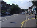
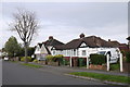
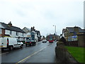
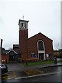
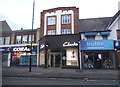
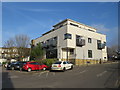
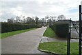
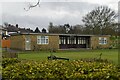
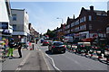
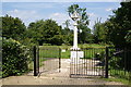
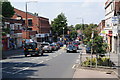
34 photos from this area
Area Information
Key information about the KT4 8JH including its size, population, and administrative classification.
- Area Type
- Postcode
- Area Size
- 1.2 hectares
- Population
- 1695
- Population Density
- 7155 people/km²
House Prices in KT4 8JH
56
Properties
£336,910
Average Sold Price
£85,000
Lowest Price
£700,000
Highest Price
Showing 56 properties
| Address | Type | Beds | Baths | Last Sale Price | Last Sale Date | |
|---|---|---|---|---|---|---|
| 86 Washington Road, Worcester Park, KT4 8JH | Flat | - | - | £295,000 | Dec 2024 | |
| 104 Washington Road, Worcester Park, KT4 8JH | Maisonette | 2 | 1 | £331,500 | Sep 2024 | |
| 52 Washington Road, Worcester Park, KT4 8JH | Terraced | 3 | 1 | £535,000 | Aug 2024 | |
| 38 Washington Road, Worcester Park, KT4 8JH | Semi-detached | 2 | 1 | £480,000 | Dec 2023 | |
| 102 Washington Road, Worcester Park, KT4 8JH | Maisonette | 2 | 1 | £320,000 | Dec 2023 | |
| 76 Washington Road, Worcester Park, KT4 8JH | Semi-detached | 2 | 2 | £425,000 | Nov 2023 | |
| 30 Washington Road, Worcester Park, KT4 8JH | Terraced | 2 | 1 | £455,000 | Sep 2023 | |
| 66 Washington Road, Worcester Park, KT4 8JH | Terraced | 3 | 1 | £537,500 | Apr 2023 | |
| 50 Washington Road, Worcester Park, KT4 8JH | house | 4 | - | £700,000 | Aug 2022 | |
| 90 Washington Road, Worcester Park, KT4 8JH | Maisonette | 2 | 1 | £325,000 | Aug 2022 |
Page 1 of 6
Energy Efficiency in KT4 8JH
Amenities
Schools
| Rank | School | Type | Entry gender | Ages |
|---|
Explore more schools in this area
Go to Schools tabDemographics
Household Size
Family (3-5 people)
most common
Accommodation Type
Houses
most common
Tenure
63
majority
Ethnic Group
White
most common
Religion
N/A
most common
Household Composition
N/A
most common
Age
47
median
Adults (30-64 years)
most common
Household Deprivation
N/A
with no deprivation
NS-SEC
39
in Lower managerial occupations
Explore more demographic insights in this area
Go to Demographics tabPlanning
Planning Constraints
- Flood RiskPremium
- Ramsar Wetland SitesPremium
- Area of Outstanding Natural BeautyPremium
- Protected Nature ReservePremium
- Protected WoodlandPremium