Area Overview for KT2 5QF
Photos of KT2 5QF


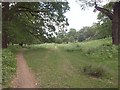
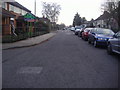
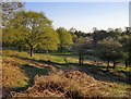

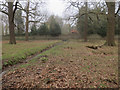

78 photos from this area
Area Information
Key information about the KT2 5QF including its size, population, and administrative classification.
- Area Type
- Postcode
- Area Size
- 1.6 hectares
- Population
- Not available
- Population Density
- Not available
House Prices in KT2 5QF
38
Properties
£572,778
Average Sold Price
£106,000
Lowest Price
£1,150,000
Highest Price
Showing 38 properties
| Address | Type | Beds | Baths | Last Sale Price | Last Sale Date | |
|---|---|---|---|---|---|---|
| 84 Tudor Drive, Kingston Upon Thames, KT2 5QF | Semi-detached | 4 | 2 | £1,150,000 | Feb 2024 | |
| 66 Tudor Drive, Kingston Upon Thames, KT2 5QF | Semi-detached | 3 | 1 | £815,000 | Jan 2024 | |
| 96 Tudor Drive, Kingston Upon Thames, KT2 5QF | Semi-detached | 3 | 1 | £810,000 | Dec 2023 | |
| 118 Tudor Drive, Kingston Upon Thames, KT2 5QF | Semi-detached | 3 | 1 | £828,000 | Feb 2023 | |
| 104 Tudor Drive, Kingston Upon Thames, KT2 5QF | house | - | - | £850,000 | Sep 2021 | |
| 62 Tudor Drive, Kingston Upon Thames, KT2 5QF | house | - | - | £750,000 | Jun 2021 | |
| 78 Tudor Drive, Kingston Upon Thames, KT2 5QF | Semi-detached | 3 | 1 | £825,000 | May 2018 | |
| 98 Tudor Drive, Kingston Upon Thames, KT2 5QF | Semi-detached | 4 | 2 | £745,000 | Mar 2018 | |
| 114 Tudor Drive, Kingston Upon Thames, KT2 5QF | Semi-detached | 3 | 1 | £690,000 | Jul 2017 | |
| 56 Tudor Drive, Kingston Upon Thames, KT2 5QF | Semi-detached | 4 | 2 | £835,000 | Feb 2017 |
Page 1 of 4
Energy Efficiency in KT2 5QF
Amenities
Schools
| Rank | School | Type | Entry gender | Ages |
|---|
Explore more schools in this area
Go to Schools tabDemographics
Household Size
Family (3-5 people)
most common
Accommodation Type
Houses
most common
Tenure
83
majority
Ethnic Group
White
most common
Religion
N/A
most common
Household Composition
N/A
most common
Age
47
median
Adults (30-64 years)
most common
Household Deprivation
N/A
with no deprivation
NS-SEC
51
in Lower managerial occupations
Explore more demographic insights in this area
Go to Demographics tabPlanning
Planning Constraints
- Flood RiskPremium
- Ramsar Wetland SitesPremium
- Area of Outstanding Natural BeautyPremium
- Protected Nature ReservePremium
- Protected WoodlandPremium