Area Overview for IG4 5PS
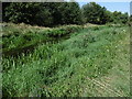
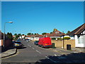
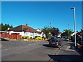
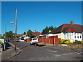
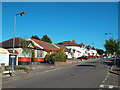
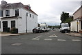
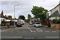
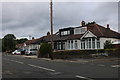
Photos of IG4 5PS


Area Information
Living in IG4 5PS means inhabiting a tightly packed residential cluster in England, where 1808 people reside across just 1.2 hectares. This density creates a compact, possibly close-knit community, though the area’s small size means every resident shares limited space. The postcode is home to a population with a median age of 47, predominantly adults aged 30–64, suggesting a mature demographic. Most residents own their homes—80%—and the area is characterised by houses rather than flats, reflecting a preference for traditional housing. The predominant ethnic group is Asian, which shapes the cultural fabric of the neighbourhood. Daily life here is likely defined by proximity to local amenities, though the area’s size limits the range of services. Commuters may rely on nearby rail and bus networks, while the digital connectivity score of 97 for broadband and 85 for mobile coverage supports modern lifestyles. Despite its small footprint, IG4 5PS offers a mix of practical living with a focus on home ownership and established community structures.
- Area Type
- Postcode
- Area Size
- 1.2 hectares
- Population
- 1808
- Population Density
- 2956 people/km²
The property market in IG4 5PS is dominated by owner-occupied homes, with 80% of residents owning their properties. This suggests a stable, long-term community with limited rental activity. The area is primarily composed of houses rather than flats or apartments, which may appeal to those seeking more space or traditional housing. Given the small area size of 1.2 hectares, the housing stock is likely limited, meaning buyers may need to consider nearby postcode areas for additional options. The focus on home ownership indicates a mature market where properties are likely to hold value. However, the compact size of the area could create competition for available homes, particularly for families or those requiring larger properties. Buyers should also consider the surrounding regions for broader choices, though the immediate vicinity offers a cohesive, residential environment.
House Prices in IG4 5PS
No properties found in this postcode.
Energy Efficiency in IG4 5PS
The lifestyle in IG4 5PS is shaped by its proximity to a range of amenities. Residents have access to five retail outlets, including Tesco Woodford and Co-op South, ensuring everyday shopping needs are met. Transport hubs like Redbridge Station, South Woodford, and Wanstead Station provide easy access to London’s rail network, while the nearby Whipps Cross Bus Interchange connects to local routes. The area’s proximity to London City Airport adds to its accessibility for travel. For leisure, the presence of two ferry piers—East India Pier and North Greenwich Pier—offers recreational opportunities. Though the data does not specify parks or green spaces, the absence of protected natural areas suggests a focus on urban living. The combination of retail, transport, and travel options creates a practical, convenient lifestyle, though the small area size may limit the diversity of local attractions.
Amenities
Schools
Residents of IG4 5PS have access to three special schools, each catering to specific educational needs. Hatton Special School and Lilyvale are both designated as special schools, though their Ofsted ratings are not specified. Stradbroke Special School holds a ‘good’ Ofsted rating, offering a benchmark of quality within the area’s educational landscape. The presence of three special schools suggests the area is well-served for families requiring tailored support for children with additional needs. However, the absence of mainstream schools in the data means the full range of educational options is unclear. For families prioritising special education, this cluster of schools provides proximity and variety, but those seeking mainstream schooling may need to look beyond the immediate postcode. The focus on special schools reflects the community’s needs and resources.
| Rank | School | Type | Entry gender | Ages |
|---|
Explore more schools in this area
Go to Schools tabDemographics
The community in IG4 5PS is composed of adults aged 30–64, making up the most common age range. With a median age of 47, the area is skewed towards middle-aged and older residents, which may influence local services and amenities. Home ownership is high at 80%, indicating a stable population with long-term residency. The accommodation type is predominantly houses, which aligns with the demographic’s preference for family-oriented or larger living spaces. The predominant ethnic group is Asian, which contributes to the area’s cultural diversity. While no specific deprivation data is provided, the high home ownership rate and focus on houses suggest a relatively secure economic profile. However, the age range implies a potential shift in demand for services tailored to older adults or retirees. The absence of detailed diversity metrics beyond the Asian group means the full extent of cultural composition remains unspecified.
Household Size
Accommodation Type
Tenure
Ethnic Group
Religion
Household Composition
Age
Household Deprivation
NS-SEC
Explore more demographic insights in this area
Go to Demographics tabPlanning
Planning Constraints
- Flood RiskPremium
- Ramsar Wetland SitesPremium
- Area of Outstanding Natural BeautyPremium
- Protected Nature ReservePremium
- Protected WoodlandPremium