Area Overview for IG11 9RB
Photos of IG11 9RB

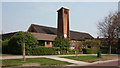
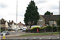

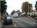
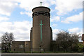


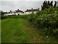


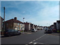
49 photos from this area
Area Information
Key information about the IG11 9RB including its size, population, and administrative classification.
- Area Type
- Postcode
- Area Size
- 9730 m²
- Population
- 1879
- Population Density
- 11008 people/km²
House Prices in IG11 9RB
28
Properties
£211,120
Average Sold Price
£41,500
Lowest Price
£365,000
Highest Price
Showing 28 properties
| Address | Type | Beds | Baths | Last Sale Price | Last Sale Date | |
|---|---|---|---|---|---|---|
| 445 Ripple Road, Barking, IG11 9RB | Semi-detached | 2 | - | £365,000 | Oct 2024 | |
| 405 Ripple Road, Barking, IG11 9RB | Terraced | 3 | 1 | £355,000 | Mar 2016 | |
| 437 Ripple Road, Barking, IG11 9RB | house | - | - | £263,000 | Oct 2015 | |
| 413 Ripple Road, Barking, IG11 9RB | house | 3 | - | £225,000 | Feb 2012 | |
| 403 Ripple Road, Barking, IG11 9RB | Terraced | 3 | 2 | £179,000 | Apr 2011 | |
| 439 Ripple Road, Barking, IG11 9RB | house | 3 | - | £185,000 | Jan 2011 | |
| 425 Ripple Road, Barking, IG11 9RB | house | - | - | £185,000 | Jan 2010 | |
| 433 Ripple Road, Barking, IG11 9RB | house | 3 | 1 | £250,000 | Mar 2005 | |
| 431 Ripple Road, Barking, IG11 9RB | house | - | - | £41,500 | Sep 1996 | |
| 401 Ripple Road, Barking, IG11 9RB | house | 2 | 1 | £62,700 | Nov 1995 |
Page 1 of 3
Energy Efficiency in IG11 9RB
Amenities
Schools
| Rank | School | Type | Entry gender | Ages |
|---|
Explore more schools in this area
Go to Schools tabDemographics
Household Size
Family (3-5 people)
most common
Accommodation Type
Houses
most common
Tenure
33
majority
Ethnic Group
White
most common
Religion
N/A
most common
Household Composition
N/A
most common
Age
47
median
Adults (30-64 years)
most common
Household Deprivation
N/A
with no deprivation
NS-SEC
19
in Lower managerial occupations
Explore more demographic insights in this area
Go to Demographics tabPlanning
Planning Constraints
- Flood RiskPremium
- Ramsar Wetland SitesPremium
- Area of Outstanding Natural BeautyPremium
- Protected Nature ReservePremium
- Protected WoodlandPremium