Area Overview for IG11 9PR
Photos of IG11 9PR
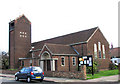
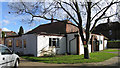
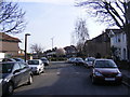
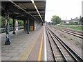
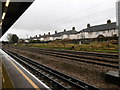
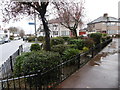
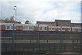
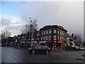
61 photos from this area
Area Information
Key information about the IG11 9PR including its size, population, and administrative classification.
- Area Type
- Postcode
- Area Size
- 6757 m²
- Population
- 1879
- Population Density
- 11008 people/km²
House Prices in IG11 9PR
28
Properties
£225,350
Average Sold Price
£48,500
Lowest Price
£405,000
Highest Price
Showing 28 properties
| Address | Type | Beds | Baths | Last Sale Price | Last Sale Date | |
|---|---|---|---|---|---|---|
| 10 Lambourne Road, Barking, IG11 9PR | house | 3 | 1 | £405,000 | Jul 2023 | |
| 37 Lambourne Road, Barking, IG11 9PR | Terraced | 2 | 1 | £305,000 | Jan 2023 | |
| 20 Lambourne Road, Barking, IG11 9PR | Terraced | 2 | 1 | £265,000 | Jun 2020 | |
| 26 Lambourne Road, Barking, IG11 9PR | Terraced | 2 | 1 | £318,000 | Aug 2019 | |
| 28 Lambourne Road, Barking, IG11 9PR | Terraced | 2 | 1 | £173,000 | Oct 2011 | |
| 25 Lambourne Road, Barking, IG11 9PR | Terraced | 2 | - | £198,000 | Jun 2008 | |
| 14 Lambourne Road, Barking, IG11 9PR | Terraced | 2 | 1 | £184,000 | Mar 2007 | |
| 32 Lambourne Road, Barking, IG11 9PR | house | - | - | £185,000 | May 2006 | |
| 41 Lambourne Road, Barking, IG11 9PR | Terraced | 2 | 1 | £172,000 | May 2005 | |
| 24 Lambourne Road, Barking, IG11 9PR | Terraced | 2 | 1 | £48,500 | Sep 1996 |
Page 1 of 3
Energy Efficiency in IG11 9PR
Amenities
Schools
| Rank | School | Type | Entry gender | Ages |
|---|
Explore more schools in this area
Go to Schools tabDemographics
Household Size
Family (3-5 people)
most common
Accommodation Type
Houses
most common
Tenure
33
majority
Ethnic Group
White
most common
Religion
N/A
most common
Household Composition
N/A
most common
Age
47
median
Adults (30-64 years)
most common
Household Deprivation
N/A
with no deprivation
NS-SEC
19
in Lower managerial occupations
Explore more demographic insights in this area
Go to Demographics tabPlanning
Planning Constraints
- Flood RiskPremium
- Ramsar Wetland SitesPremium
- Area of Outstanding Natural BeautyPremium
- Protected Nature ReservePremium
- Protected WoodlandPremium