Area Overview for IG11 9LX
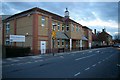
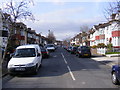
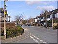
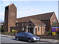
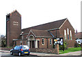
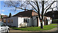
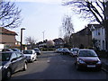
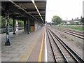
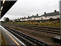
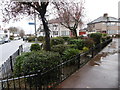
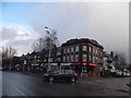
Photos of IG11 9LX

Area Information
Living in IG11 9LX means being part of a tightly packed residential cluster in east London, where 2,607 people inhabit just 8,960 square metres. This high population density creates a compact, tightly knit community, with homes primarily in traditional houses rather than flats. The area’s proximity to major transport hubs like Upney Station, Barking Station, and Woolwich Ferry piers makes it a practical choice for commuters. Despite its small size, IG11 9LX is well-connected to retail, rail, and ferry services, including nearby Tesco Barking and London City Airport. The median age of 47 suggests a mature population, with a strong presence of adults aged 30–64. This is not a young, transient area but one with established residents, many of whom own their homes. Daily life here balances convenience with the constraints of limited space, where every square metre is shared with neighbours and essential services.
- Area Type
- Postcode
- Area Size
- 8960 m²
- Population
- 2607
- Population Density
- 9631 people/km²
The property market in IG11 9LX is dominated by owner-occupied homes, with 61% of residents owning their properties. This suggests a stable market where long-term residency is common. The accommodation type is primarily houses, which is atypical for a high-density area but indicates a focus on traditional, family-friendly housing. Given the small area size and high population density, the housing stock is likely limited, with properties competing for space. Buyers should consider that this is not a rental-heavy area, meaning demand for homes may be strong among existing residents. The compact nature of the postcode means that properties are closely clustered, with little room for expansion. For those seeking a home, the emphasis on houses rather than flats may appeal to those prioritising space and privacy, though availability could be constrained by the area’s physical limits.
House Prices in IG11 9LX
Showing 5 properties
| Address | Type | Beds | Baths | Last Sale Price | Last Sale Date | |
|---|---|---|---|---|---|---|
| Genito Urinary Medicine Clinic, Barking Hospital, Upney Lane, Barking, IG11 9LX | commercial | - | - | - | - | |
| Community Diagnostic Centre, Barking Hospital, Upney Lane, Barking, IG11 9LX | hospital_care_home | - | - | - | - | |
| Highgrove Surgery, Barking Hospital, Upney Lane, Barking, IG11 9LX | commercial | - | - | - | - | |
| Britannia Pharmacy, Pharmacy, Barking Hospital, Upney Lane, Barking, IG11 9LX | commercial | - | - | - | - | |
| Barking Community Birth Centre, Barking Hospital, Upney Lane, Barking, IG11 9LX | hospital_care_home | - | - | - | - |
Energy Efficiency in IG11 9LX
Life in IG11 9LX is shaped by its proximity to a range of amenities, from retail to transport. Nearby shops include Tesco Barking, Co-op Faircross, and Co-op Porters, offering everyday essentials. The area’s five metro stations, including Upney and East Ham, and five rail stations such as Barking Riverside, provide seamless access to London’s transport network. Ferry services at Woolwich Arsenal Pier and Barrier Gardens Pier add another layer of connectivity, while London City Airport is within reach. The presence of multiple transport options means residents can easily navigate the city or commute to nearby suburbs. The compact nature of the area means amenities are closely clustered, reducing the need for long journeys. This density supports a convenient lifestyle, where shopping, travel, and work opportunities are all within walking or short transit distance.
Amenities
Schools
| Rank | School | Type | Entry gender | Ages |
|---|
Explore more schools in this area
Go to Schools tabDemographics
The community in IG11 9LX is predominantly composed of adults aged 30–64, with a median age of 47. This reflects a mature population, likely with established careers and families. Home ownership is strong, with 61% of residents owning their homes, suggesting stability and long-term commitment to the area. The accommodation type is primarily houses, which is unusual in high-density urban settings but indicates a mix of older, more spacious properties. The predominant ethnic group is Asian, which shapes the cultural character of the area. With a population density of 290,952 people per square kilometre, living here means close proximity to neighbours and amenities, but also potential challenges with space and noise. This density underscores the need for efficient land use, with every square metre serving multiple purposes.
Household Size
Accommodation Type
Tenure
Ethnic Group
Religion
Household Composition
Age
Household Deprivation
NS-SEC
Explore more demographic insights in this area
Go to Demographics tabPlanning
Planning Constraints
- Flood RiskPremium
- Ramsar Wetland SitesPremium
- Area of Outstanding Natural BeautyPremium
- Protected Nature ReservePremium
- Protected WoodlandPremium