Area Overview for IG11 9HZ
Photos of IG11 9HZ
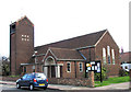
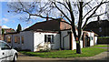
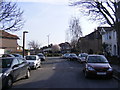
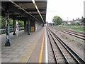
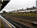
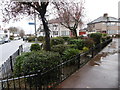
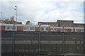
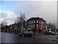
61 photos from this area
Area Information
Key information about the IG11 9HZ including its size, population, and administrative classification.
- Area Type
- Postcode
- Area Size
- 7819 m²
- Population
- 2096
- Population Density
- 10454 people/km²
House Prices in IG11 9HZ
26
Properties
£319,009
Average Sold Price
£69,995
Lowest Price
£575,000
Highest Price
Showing 26 properties
| Address | Type | Beds | Baths | Last Sale Price | Last Sale Date | |
|---|---|---|---|---|---|---|
| 114 Beccles Drive, Barking, IG11 9HZ | Terraced | 4 | 1 | £575,000 | Jul 2022 | |
| 129 Beccles Drive, Barking, IG11 9HZ | Terraced | 3 | 1 | £505,000 | May 2022 | |
| 135 Beccles Drive, Barking, IG11 9HZ | house | 4 | - | £300,000 | Aug 2019 | |
| 125 Beccles Drive, Barking, IG11 9HZ | Terraced | 3 | 1 | £435,500 | Oct 2017 | |
| 143 Beccles Drive, Barking, IG11 9HZ | Terraced | 3 | 1 | £485,000 | Feb 2017 | |
| 118 Beccles Drive, Barking, IG11 9HZ | house | 5 | 2 | £565,000 | Feb 2016 | |
| 137 Beccles Drive, Barking, IG11 9HZ | Terraced | 3 | - | £340,000 | Nov 2014 | |
| 145 Beccles Drive, Barking, IG11 9HZ | Semi-detached | 1 | 1 | £365,000 | Apr 2014 | |
| 133 Beccles Drive, Barking, IG11 9HZ | house | - | - | £350,000 | Feb 2013 | |
| 110 Beccles Drive, Barking, IG11 9HZ | house | - | - | £354,200 | Jan 2013 |
Page 1 of 3
Energy Efficiency in IG11 9HZ
Amenities
Schools
| Rank | School | Type | Entry gender | Ages |
|---|
Explore more schools in this area
Go to Schools tabDemographics
Household Size
Family (3-5 people)
most common
Accommodation Type
Houses
most common
Tenure
84
majority
Ethnic Group
asian_total
most common
Religion
N/A
most common
Household Composition
N/A
most common
Age
47
median
Adults (30-64 years)
most common
Household Deprivation
N/A
with no deprivation
NS-SEC
32
in Lower managerial occupations
Explore more demographic insights in this area
Go to Demographics tabPlanning
Planning Constraints
- Flood RiskPremium
- Ramsar Wetland SitesPremium
- Area of Outstanding Natural BeautyPremium
- Protected Nature ReservePremium
- Protected WoodlandPremium