Area Overview for IG11 8QS
Photos of IG11 8QS
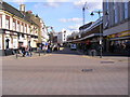
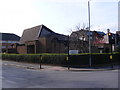
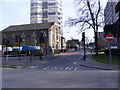
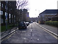
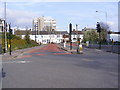

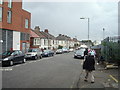
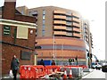
100 photos from this area
Area Information
Key information about the IG11 8QS including its size, population, and administrative classification.
- Area Type
- Postcode
- Area Size
- 4732 m²
- Population
- 1804
- Population Density
- 14105 people/km²
House Prices in IG11 8QS
27
Properties
£184,321
Average Sold Price
£111,250
Lowest Price
£235,000
Highest Price
Showing 27 properties
| Address | Type | Beds | Baths | Last Sale Price | Last Sale Date | |
|---|---|---|---|---|---|---|
| 60 Bateman Close, Barking, IG11 8QS | Flat | 1 | 1 | £222,000 | Dec 2024 | |
| 55 Bateman Close, Barking, IG11 8QS | Flat | 1 | 1 | £235,000 | Nov 2022 | |
| 59 Bateman Close, Barking, IG11 8QS | Flat | 1 | 1 | £225,000 | May 2022 | |
| 70 Bateman Close, Barking, IG11 8QS | Flat | 1 | 1 | £220,000 | Mar 2022 | |
| 79 Bateman Close, Barking, IG11 8QS | Flat | - | - | £149,000 | Oct 2014 | |
| 57 Bateman Close, Barking, IG11 8QS | Flat | - | - | £111,250 | Jun 2007 | |
| 65 Bateman Close, Barking, IG11 8QS | Flat | - | - | £128,000 | Nov 2006 | |
| 80 Bateman Close, Barking, IG11 8QS | Flat | 1 | 1 | - | - | |
| 69 Bateman Close, Barking, IG11 8QS | Flat | 1 | 1 | - | - | |
| 78 Bateman Close, Barking, IG11 8QS | Flat | - | - | - | - |
Page 1 of 3
Energy Efficiency in IG11 8QS
Amenities
Schools
| Rank | School | Type | Entry gender | Ages |
|---|
Explore more schools in this area
Go to Schools tabDemographics
Household Size
Family (3-5 people)
most common
Accommodation Type
Houses
most common
Tenure
33
majority
Ethnic Group
asian_total
most common
Religion
N/A
most common
Household Composition
N/A
most common
Age
47
median
Adults (30-64 years)
most common
Household Deprivation
N/A
with no deprivation
NS-SEC
19
in Lower managerial occupations
Explore more demographic insights in this area
Go to Demographics tabPlanning
Planning Constraints
- Flood RiskPremium
- Ramsar Wetland SitesPremium
- Area of Outstanding Natural BeautyPremium
- Protected Nature ReservePremium
- Protected WoodlandPremium