Area Overview for IG11 0LX
Photos of IG11 0LX


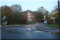
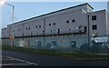


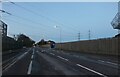
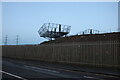
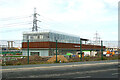
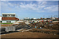
53 photos from this area
Area Information
Key information about the IG11 0LX including its size, population, and administrative classification.
- Area Type
- Postcode
- Area Size
- 2.3 hectares
- Population
- 2091
- Population Density
- 8493 people/km²
House Prices in IG11 0LX
65
Properties
£201,886
Average Sold Price
£66,500
Lowest Price
£410,000
Highest Price
Showing 65 properties
| Address | Type | Beds | Baths | Last Sale Price | Last Sale Date | |
|---|---|---|---|---|---|---|
| 10 Alderman Avenue, Barking, IG11 0LX | Terraced | 4 | 2 | £215,530 | Sep 2025 | |
| 62 Alderman Avenue, Barking, IG11 0LX | Terraced | 3 | 1 | £410,000 | Feb 2025 | |
| 30 Alderman Avenue, Barking, IG11 0LX | Flat | - | - | £177,500 | Apr 2022 | |
| 40 Alderman Avenue, Barking, IG11 0LX | house | - | - | £350,000 | Feb 2021 | |
| 27 Alderman Avenue, Barking, IG11 0LX | Semi-detached | 3 | 1 | £358,000 | Jun 2020 | |
| 16 Alderman Avenue, Barking, IG11 0LX | Terraced | 3 | - | £325,000 | Nov 2018 | |
| 32 Alderman Avenue, Barking, IG11 0LX | Flat | - | - | £175,000 | Oct 2018 | |
| 44 Alderman Avenue, Barking, IG11 0LX | Terraced | 3 | 1 | £350,000 | Oct 2017 | |
| 50 Alderman Avenue, Barking, IG11 0LX | Flat | - | - | £120,000 | Nov 2013 | |
| 60 Alderman Avenue, Barking, IG11 0LX | house | - | - | £185,000 | May 2012 |
Page 1 of 7
Energy Efficiency in IG11 0LX
Amenities
Schools
| Rank | School | Type | Entry gender | Ages |
|---|
Explore more schools in this area
Go to Schools tabDemographics
Household Size
Family (3-5 people)
most common
Accommodation Type
Houses
most common
Tenure
30
majority
Ethnic Group
black_total
most common
Religion
N/A
most common
Household Composition
N/A
most common
Age
47
median
Adults (30-64 years)
most common
Household Deprivation
N/A
with no deprivation
NS-SEC
17
in Lower managerial occupations
Explore more demographic insights in this area
Go to Demographics tabPlanning
Planning Constraints
- Flood RiskPremium
- Ramsar Wetland SitesPremium
- Area of Outstanding Natural BeautyPremium
- Protected Nature ReservePremium
- Protected WoodlandPremium