Area Overview for IG11 0LJ
Photos of IG11 0LJ
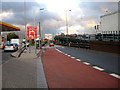

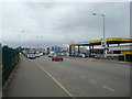


51 photos from this area
Area Information
Key information about the IG11 0LJ including its size, population, and administrative classification.
- Area Type
- Postcode
- Area Size
- 8605 m²
- Population
- 2091
- Population Density
- 8493 people/km²
House Prices in IG11 0LJ
39
Properties
£229,455
Average Sold Price
£140,000
Lowest Price
£400,000
Highest Price
Showing 39 properties
| Address | Type | Beds | Baths | Last Sale Price | Last Sale Date | |
|---|---|---|---|---|---|---|
| 242 Bastable Avenue, Barking, IG11 0LJ | Maisonette | - | - | £247,000 | Jan 2022 | |
| 298 Bastable Avenue, Barking, IG11 0LJ | house | 1 | 1 | £262,000 | Mar 2020 | |
| 288 Bastable Avenue, Barking, IG11 0LJ | Flat | - | - | £175,000 | Jul 2018 | |
| 294 Bastable Avenue, Barking, IG11 0LJ | house | 4 | 2 | £400,000 | May 2017 | |
| 262 Bastable Avenue, Barking, IG11 0LJ | Maisonette | 2 | 1 | £200,000 | Oct 2016 | |
| 310 Bastable Avenue, Barking, IG11 0LJ | house | 3 | - | £193,000 | Nov 2011 | |
| 296 Bastable Avenue, Barking, IG11 0LJ | Terraced | 3 | 1 | £190,000 | Nov 2010 | |
| 292 Bastable Avenue, Barking, IG11 0LJ | house | 1 | 3 | £232,000 | Feb 2009 | |
| 306 Bastable Avenue, Barking, IG11 0LJ | house | 6 | 2 | £320,000 | Feb 2008 | |
| 304 Bastable Avenue, Barking, IG11 0LJ | Terraced | - | - | £165,000 | Dec 2003 |
Page 1 of 4
Energy Efficiency in IG11 0LJ
Amenities
Schools
| Rank | School | Type | Entry gender | Ages |
|---|
Explore more schools in this area
Go to Schools tabDemographics
Household Size
Family (3-5 people)
most common
Accommodation Type
Houses
most common
Tenure
30
majority
Ethnic Group
black_total
most common
Religion
N/A
most common
Household Composition
N/A
most common
Age
47
median
Adults (30-64 years)
most common
Household Deprivation
N/A
with no deprivation
NS-SEC
17
in Lower managerial occupations
Explore more demographic insights in this area
Go to Demographics tabPlanning
Planning Constraints
- Flood RiskPremium
- Ramsar Wetland SitesPremium
- Area of Outstanding Natural BeautyPremium
- Protected Nature ReservePremium
- Protected WoodlandPremium