Area Overview for IG1 4HZ
Photos of IG1 4HZ
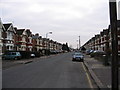
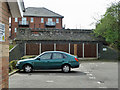
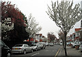
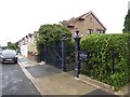
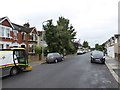
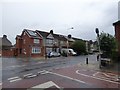
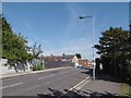
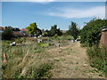
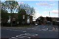
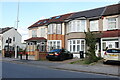
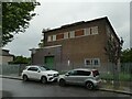
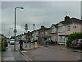
53 photos from this area
Area Information
Key information about the IG1 4HZ including its size, population, and administrative classification.
- Area Type
- Postcode
- Area Size
- 1.1 hectares
- Population
- 2496
- Population Density
- 9846 people/km²
House Prices in IG1 4HZ
39
Properties
£312,430
Average Sold Price
£64,250
Lowest Price
£615,000
Highest Price
Showing 39 properties
| Address | Type | Beds | Baths | Last Sale Price | Last Sale Date | |
|---|---|---|---|---|---|---|
| 298 Balfour Road, Ilford, IG1 4HZ | Terraced | 3 | 1 | £575,000 | Jun 2025 | |
| 270 Balfour Road, Ilford, IG1 4HZ | Terraced | 3 | 1 | £410,000 | Dec 2024 | |
| 316 Balfour Road, Ilford, IG1 4HZ | house | - | - | £550,000 | Nov 2022 | |
| 310 Balfour Road, Ilford, IG1 4HZ | Retail | 3 | 1 | £515,000 | Aug 2022 | |
| 280 Balfour Road, Ilford, IG1 4HZ | Terraced | 4 | 2 | £615,000 | Jun 2022 | |
| 312 Balfour Road, Ilford, IG1 4HZ | Terraced | 4 | - | £500,000 | Mar 2021 | |
| 278 Balfour Road, Ilford, IG1 4HZ | Terraced | 3 | 2 | £460,000 | Nov 2019 | |
| 282 Balfour Road, Ilford, IG1 4HZ | Terraced | 3 | 1 | £450,000 | Jan 2019 | |
| 304 Balfour Road, Ilford, IG1 4HZ | Flat | - | 1 | £495,000 | Nov 2016 | |
| 258 Balfour Road, Ilford, IG1 4HZ | Terraced | 3 | 1 | £360,000 | Sep 2014 |
Page 1 of 4
Energy Efficiency in IG1 4HZ
Amenities
Schools
| Rank | School | Type | Entry gender | Ages |
|---|
Explore more schools in this area
Go to Schools tabDemographics
Household Size
Family (3-5 people)
most common
Accommodation Type
Houses
most common
Tenure
58
majority
Ethnic Group
asian_total
most common
Religion
N/A
most common
Household Composition
N/A
most common
Age
47
median
Adults (30-64 years)
most common
Household Deprivation
N/A
with no deprivation
NS-SEC
28
in Lower managerial occupations
Explore more demographic insights in this area
Go to Demographics tabPlanning
Planning Constraints
- Flood RiskPremium
- Ramsar Wetland SitesPremium
- Area of Outstanding Natural BeautyPremium
- Protected Nature ReservePremium
- Protected WoodlandPremium