Area Overview for HA8 9UT
Photos of HA8 9UT
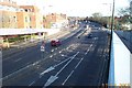
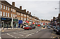
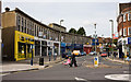

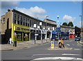
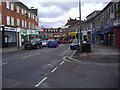
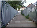
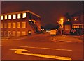
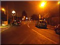
60 photos from this area
Area Information
Key information about the HA8 9UT including its size, population, and administrative classification.
- Area Type
- Postcode
- Area Size
- 1.7 hectares
- Population
- 1997
- Population Density
- 7032 people/km²
House Prices in HA8 9UT
34
Properties
£547,497
Average Sold Price
£195,000
Lowest Price
£940,000
Highest Price
Showing 34 properties
| Address | Type | Beds | Baths | Last Sale Price | Last Sale Date | |
|---|---|---|---|---|---|---|
| 25 St Margarets Road, Edgware, HA8 9UT | Semi-detached | 4 | 2 | £880,000 | Mar 2023 | |
| 31 St Margarets Road, Edgware, HA8 9UT | Retail | 4 | 2 | £940,000 | Nov 2022 | |
| 33 St Margarets Road, Edgware, HA8 9UT | Semi-detached | 4 | 4 | £730,000 | Feb 2021 | |
| 57 St Margarets Road, Edgware, HA8 9UT | house | - | - | £599,950 | Oct 2020 | |
| 59 St Margarets Road, Edgware, HA8 9UT | Semi-detached | 3 | 1 | £635,000 | Feb 2019 | |
| 71 St Margarets Road, Edgware, HA8 9UT | Semi-detached | 3 | 1 | £480,000 | Jan 2014 | |
| 49 St Margarets Road, Edgware, HA8 9UT | Detached | 7 | 6 | £710,000 | Oct 2012 | |
| 43 St Margarets Road, Edgware, HA8 9UT | house | 4 | - | £530,000 | Nov 2010 | |
| 63 St Margarets Road, Edgware, HA8 9UT | Retail | 3 | 1 | £515,000 | Jun 2008 | |
| 41 St Margarets Road, Edgware, HA8 9UT | Semi-detached | - | - | £570,000 | Apr 2008 |
Page 1 of 4
Energy Efficiency in HA8 9UT
Amenities
Schools
| Rank | School | Type | Entry gender | Ages |
|---|
Explore more schools in this area
Go to Schools tabDemographics
Household Size
Family (3-5 people)
most common
Accommodation Type
Houses
most common
Tenure
55
majority
Ethnic Group
White
most common
Religion
N/A
most common
Household Composition
N/A
most common
Age
47
median
Adults (30-64 years)
most common
Household Deprivation
N/A
with no deprivation
NS-SEC
36
in Lower managerial occupations
Explore more demographic insights in this area
Go to Demographics tabPlanning
Planning Constraints
- Flood RiskPremium
- Ramsar Wetland SitesPremium
- Area of Outstanding Natural BeautyPremium
- Protected Nature ReservePremium
- Protected WoodlandPremium