Area Overview for HA7 2JD
Photos of HA7 2JD
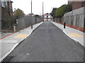
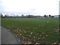
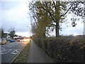
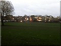

47 photos from this area
Area Information
Key information about the HA7 2JD including its size, population, and administrative classification.
- Area Type
- Postcode
- Area Size
- 7720 m²
- Population
- 2200
- Population Density
- 8076 people/km²
House Prices in HA7 2JD
21
Properties
£326,497
Average Sold Price
£74,000
Lowest Price
£875,000
Highest Price
Showing 21 properties
| Address | Type | Beds | Baths | Last Sale Price | Last Sale Date | |
|---|---|---|---|---|---|---|
| 31 Rocklands Drive, Stanmore, HA7 2JD | Semi-detached | 3 | 1 | £580,000 | Sep 2023 | |
| 41 Rocklands Drive, Stanmore, HA7 2JD | Detached | 4 | 2 | £875,000 | Dec 2022 | |
| 13 Rocklands Drive, Stanmore, HA7 2JD | Semi-detached | 3 | 2 | £610,000 | Apr 2022 | |
| 11 Rocklands Drive, Stanmore, HA7 2JD | house | - | - | £380,000 | Jun 2018 | |
| 19 Rocklands Drive, Stanmore, HA7 2JD | Semi-detached | 4 | 1 | £610,000 | Apr 2016 | |
| 39 Rocklands Drive, Stanmore, HA7 2JD | house | - | - | £335,000 | Nov 2008 | |
| 23 Rocklands Drive, Stanmore, HA7 2JD | house | - | - | £249,950 | Jul 2006 | |
| 15 Rocklands Drive, Stanmore, HA7 2JD | house | - | - | £247,995 | Jan 2006 | |
| 17 Rocklands Drive, Stanmore, HA7 2JD | Semi-detached | - | - | £283,500 | Jul 2005 | |
| 27 Rocklands Drive, Stanmore, HA7 2JD | Semi-detached | - | - | £263,000 | Jan 2004 |
Page 1 of 3
Energy Efficiency in HA7 2JD
Amenities
Schools
| Rank | School | Type | Entry gender | Ages |
|---|
Explore more schools in this area
Go to Schools tabDemographics
Household Size
Family (3-5 people)
most common
Accommodation Type
Houses
most common
Tenure
67
majority
Ethnic Group
asian_total
most common
Religion
N/A
most common
Household Composition
N/A
most common
Age
47
median
Adults (30-64 years)
most common
Household Deprivation
N/A
with no deprivation
NS-SEC
31
in Lower managerial occupations
Explore more demographic insights in this area
Go to Demographics tabPlanning
Planning Constraints
- Flood RiskPremium
- Ramsar Wetland SitesPremium
- Area of Outstanding Natural BeautyPremium
- Protected Nature ReservePremium
- Protected WoodlandPremium