Area Overview for HA7 2JA
Photos of HA7 2JA
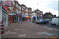
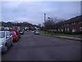
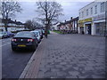

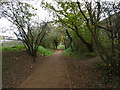
57 photos from this area
Area Information
Key information about the HA7 2JA including its size, population, and administrative classification.
- Area Type
- Postcode
- Area Size
- 6882 m²
- Population
- 1840
- Population Density
- 9123 people/km²
House Prices in HA7 2JA
19
Properties
£269,961
Average Sold Price
£85,000
Lowest Price
£681,500
Highest Price
Showing 19 properties
| Address | Type | Beds | Baths | Last Sale Price | Last Sale Date | |
|---|---|---|---|---|---|---|
| 29 Grange Avenue, Stanmore, HA7 2JA | Semi-detached | 3 | 1 | £536,000 | Mar 2025 | |
| 37 Grange Avenue, Stanmore, HA7 2JA | Detached | 4 | 2 | £681,500 | Jul 2024 | |
| 33 Grange Avenue, Stanmore, HA7 2JA | Semi-detached | 3 | 1 | £525,000 | Dec 2020 | |
| 17 Grange Avenue, Stanmore, HA7 2JA | house | 3 | 1 | £530,000 | Feb 2017 | |
| 9 Grange Avenue, Stanmore, HA7 2JA | Detached | 4 | 2 | £249,950 | May 2005 | |
| 1 Grange Avenue, Stanmore, HA7 2JA | Semi-detached | 3 | 1 | £220,000 | Mar 2002 | |
| 5 Grange Avenue, Stanmore, HA7 2JA | Semi-detached | - | - | £181,000 | Jul 2001 | |
| 11 Grange Avenue, Stanmore, HA7 2JA | Semi-detached | - | - | £156,000 | Dec 1999 | |
| 27 Grange Avenue, Stanmore, HA7 2JA | Semi-detached | 3 | 1 | £127,000 | Aug 1999 | |
| 3 Grange Avenue, Stanmore, HA7 2JA | Semi-detached | 3 | 1 | £134,000 | Jun 1999 |
Page 1 of 2
Energy Efficiency in HA7 2JA
Amenities
Schools
| Rank | School | Type | Entry gender | Ages |
|---|
Explore more schools in this area
Go to Schools tabDemographics
Household Size
Family (3-5 people)
most common
Accommodation Type
Houses
most common
Tenure
83
majority
Ethnic Group
asian_total
most common
Religion
N/A
most common
Household Composition
N/A
most common
Age
47
median
Adults (30-64 years)
most common
Household Deprivation
N/A
with no deprivation
NS-SEC
38
in Lower managerial occupations
Explore more demographic insights in this area
Go to Demographics tabPlanning
Planning Constraints
- Flood RiskPremium
- Ramsar Wetland SitesPremium
- Area of Outstanding Natural BeautyPremium
- Protected Nature ReservePremium
- Protected WoodlandPremium