Area Overview for HA7 2EP
Photos of HA7 2EP
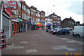
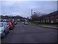
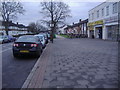

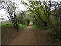
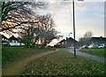
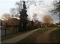
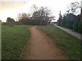
57 photos from this area
Area Information
Key information about the HA7 2EP including its size, population, and administrative classification.
- Area Type
- Postcode
- Area Size
- 8083 m²
- Population
- 2200
- Population Density
- 8076 people/km²
House Prices in HA7 2EP
21
Properties
£382,200
Average Sold Price
£85,000
Lowest Price
£812,000
Highest Price
Showing 21 properties
| Address | Type | Beds | Baths | Last Sale Price | Last Sale Date | |
|---|---|---|---|---|---|---|
| 2 Floriston Gardens, Stanmore, HA7 2EP | Detached | 3 | 2 | £660,000 | Jul 2025 | |
| 12 Floriston Gardens, Stanmore, HA7 2EP | house | - | - | £739,000 | Jun 2022 | |
| 10 Floriston Gardens, Stanmore, HA7 2EP | Retail | 5 | 2 | £812,000 | May 2022 | |
| 20 Floriston Gardens, Stanmore, HA7 2EP | house | 3 | 1 | £605,000 | Mar 2022 | |
| 11 Floriston Gardens, Stanmore, HA7 2EP | Semi-detached | 4 | - | £480,000 | Jul 2020 | |
| 18 Floriston Gardens, Stanmore, HA7 2EP | house | 4 | - | £443,000 | Sep 2011 | |
| 6 Floriston Gardens, Stanmore, HA7 2EP | house | 3 | - | £315,000 | Jul 2010 | |
| 21 Floriston Gardens, Stanmore, HA7 2EP | Semi-detached | 5 | 3 | £323,000 | Sep 2009 | |
| 15 Floriston Gardens, Stanmore, HA7 2EP | Detached | 3 | 1 | £285,000 | Sep 2009 | |
| 14 Floriston Gardens, Stanmore, HA7 2EP | house | - | - | £351,250 | Oct 2006 |
Page 1 of 3
Energy Efficiency in HA7 2EP
Amenities
Schools
| Rank | School | Type | Entry gender | Ages |
|---|
Explore more schools in this area
Go to Schools tabDemographics
Household Size
Family (3-5 people)
most common
Accommodation Type
Houses
most common
Tenure
67
majority
Ethnic Group
asian_total
most common
Religion
N/A
most common
Household Composition
N/A
most common
Age
47
median
Adults (30-64 years)
most common
Household Deprivation
N/A
with no deprivation
NS-SEC
31
in Lower managerial occupations
Explore more demographic insights in this area
Go to Demographics tabPlanning
Planning Constraints
- Flood RiskPremium
- Ramsar Wetland SitesPremium
- Area of Outstanding Natural BeautyPremium
- Protected Nature ReservePremium
- Protected WoodlandPremium