Area Overview for HA7 2EG
Photos of HA7 2EG
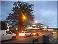
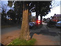
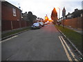
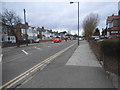
47 photos from this area
Area Information
Key information about the HA7 2EG including its size, population, and administrative classification.
- Area Type
- Postcode
- Area Size
- 7549 m²
- Population
- 2200
- Population Density
- 8076 people/km²
House Prices in HA7 2EG
15
Properties
£337,450
Average Sold Price
£140,000
Lowest Price
£710,000
Highest Price
Showing 15 properties
| Address | Type | Beds | Baths | Last Sale Price | Last Sale Date | |
|---|---|---|---|---|---|---|
| 120 Wemborough Road, Stanmore, HA7 2EG | Semi-detached | 3 | 2 | £710,000 | Sep 2025 | |
| 124 Wemborough Road, Stanmore, HA7 2EG | Detached | 3 | 2 | £435,000 | Jan 2014 | |
| 138 Wemborough Road, Stanmore, HA7 2EG | Semi-detached | 3 | - | £532,000 | Jan 2011 | |
| 116 Wemborough Road, Stanmore, HA7 2EG | house | - | - | £350,000 | May 2009 | |
| 130 Wemborough Road, Stanmore, HA7 2EG | Semi-detached | - | - | £268,000 | Jun 2002 | |
| 140 Wemborough Road, Stanmore, HA7 2EG | Detached | 4 | 4 | £322,000 | Feb 2002 | |
| 126 Wemborough Road, Stanmore, HA7 2EG | Detached | 5 | 3 | £249,950 | Feb 2001 | |
| 114 Wemborough Road, Stanmore, HA7 2EG | Semi-detached | 4 | 1 | £242,000 | May 2000 | |
| 132 Wemborough Road, Stanmore, HA7 2EG | Semi-detached | - | - | £183,000 | Jul 1998 | |
| 112 Wemborough Road, Stanmore, HA7 2EG | Semi-detached | - | - | £280,000 | Jun 1997 |
Page 1 of 2
Energy Efficiency in HA7 2EG
Amenities
Schools
| Rank | School | Type | Entry gender | Ages |
|---|
Explore more schools in this area
Go to Schools tabDemographics
Household Size
Family (3-5 people)
most common
Accommodation Type
Houses
most common
Tenure
67
majority
Ethnic Group
asian_total
most common
Religion
N/A
most common
Household Composition
N/A
most common
Age
47
median
Adults (30-64 years)
most common
Household Deprivation
N/A
with no deprivation
NS-SEC
31
in Lower managerial occupations
Explore more demographic insights in this area
Go to Demographics tabPlanning
Planning Constraints
- Flood RiskPremium
- Ramsar Wetland SitesPremium
- Area of Outstanding Natural BeautyPremium
- Protected Nature ReservePremium
- Protected WoodlandPremium