Area Overview for HA6 3AS
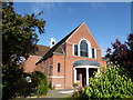
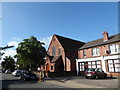
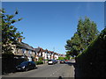
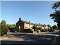
Photos of HA6 3AS
Area Information
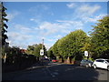
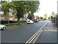
HA6 3AS is a compact residential postcode area in England, spanning just 1.7 hectares and home to 1,599 residents. Its high population density of 92,113 people per square kilometre reflects a tightly knit community, where daily life is shaped by proximity to amenities and transport links. The area’s small size means it is likely a cluster of homes rather than a sprawling suburb, with a focus on accessibility to nearby services. Residents benefit from being close to major transport hubs, including metro and rail stations, as well as retail options like Waitrose Northwood and Tesco Northwood. The area’s demographic profile suggests a mature population, with a median age of 47 and a majority of adults aged 30–64. This hints at a community rooted in stability, with a mix of homeowners and renters. While the data does not specify cultural diversity, the predominant ethnic group is White, indicating a homogeneous demographic. Living here offers a blend of convenience and familiarity, though the small footprint means space is limited, requiring residents to look beyond the immediate area for broader opportunities.
- Area Type
- Postcode
- Area Size
- 1.7 hectares
- Population
- 1599
- Population Density
- 4377 people/km²
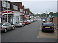
HA6 3AS is a predominantly owner-occupied area, with 60% of residents living in homes they own. The accommodation type is primarily houses, which may suggest a focus on single-family dwellings rather than apartments or flats. This aligns with the area’s compact size and high population density, implying that properties are likely to be smaller in scale but densely packed. The limited size of the postcode area means the housing stock is constrained, and buyers may need to consider nearby zones for more options. The high home ownership rate could indicate a stable market, with fewer rental properties available. For buyers, this suggests a community of long-term residents, which may contribute to a sense of continuity and security. However, the small footprint of HA6 3AS means the property market is likely to be niche, with limited availability and potentially higher competition for available homes.
House Prices in HA6 3AS
Showing 1 properties
| Address | Type | Beds | Baths | Last Sale Price | Last Sale Date | |
|---|---|---|---|---|---|---|
| Fitzwalters, St Helen's School, Eastbury Road, Northwood, HA6 3AS | commercial | - | - | - | - |
Energy Efficiency in HA6 3AS
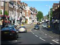
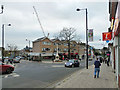
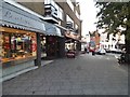
Residents of HA6 3AS have access to a range of amenities within practical reach. The retail sector includes notable stores such as Waitrose Northwood and Tesco Northwood, providing a mix of high-end and everyday shopping options. The area’s proximity to multiple metro and rail stations, including Willow Lawn and Hatch End, ensures easy access to public transport, which is essential for commuting and socialising. The presence of RAF Northolt nearby adds a unique dimension to the local landscape, though it is not a typical leisure amenity. While the data does not specify parks or recreational spaces, the high population density suggests that public areas may be limited, requiring residents to venture further for green spaces. Overall, the lifestyle in HA6 3AS is characterised by convenience and accessibility, with a focus on practicality over expansive leisure options.
Amenities
Schools
The nearest school to HA6 3AS is St Helen’s School, an independent institution. While no Ofsted rating is provided, the presence of an independent school suggests a focus on private education, which may appeal to families seeking specific curricula or facilities. However, the data does not include details on other schools in the area, so it is unclear whether there are state-funded options nearby. The absence of additional schools means the educational landscape is limited to this single institution, which could be a consideration for families requiring a range of schooling choices. Independent schools often cater to specific needs, such as smaller class sizes or specialized programs, but they may also come with higher costs. Without further data on school performance or accessibility, prospective residents must rely on the limited information available about St Helen’s School.
| Rank | School | Type | Entry gender | Ages |
|---|
Explore more schools in this area
Go to Schools tabDemographics
The population of HA6 3AS is predominantly adults aged 30–64, with a median age of 47. This suggests a community of established professionals and families, rather than a younger, transient population. Home ownership stands at 60%, indicating a balance between owner-occupied properties and rental housing. The accommodation type is primarily houses, which may imply a focus on larger, family-friendly homes. The predominant ethnic group is White, though no specific figures on diversity or deprivation are provided. The high population density of 92,113 people per square kilometre means the area is densely populated, which could influence the availability of public spaces and the character of the neighbourhood. For residents, this density may translate to a sense of community but could also mean limited private outdoor space. The data does not indicate any significant socio-economic challenges, but the lack of specific deprivation metrics means it is difficult to assess broader quality-of-life factors beyond the given statistics.
Household Size
Accommodation Type
Tenure
Ethnic Group
Religion
Household Composition
Age
Household Deprivation
NS-SEC
Explore more demographic insights in this area
Go to Demographics tabPlanning
Planning Constraints
- Flood RiskPremium
- Ramsar Wetland SitesPremium
- Area of Outstanding Natural BeautyPremium
- Protected Nature ReservePremium
- Protected WoodlandPremium