Area Overview for HA4 6HW
Photos of HA4 6HW
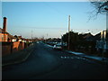
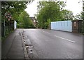
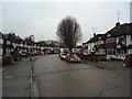
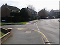
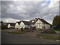
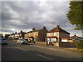
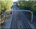
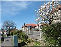
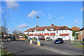
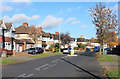
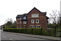
39 photos from this area
Area Information
Key information about the HA4 6HW including its size, population, and administrative classification.
- Area Type
- Postcode
- Area Size
- 7372 m²
- Population
- 1604
- Population Density
- 4345 people/km²
House Prices in HA4 6HW
24
Properties
£387,122
Average Sold Price
£98,000
Lowest Price
£735,000
Highest Price
Showing 24 properties
| Address | Type | Beds | Baths | Last Sale Price | Last Sale Date | |
|---|---|---|---|---|---|---|
| 41 Westfield Way, Ruislip, HA4 6HW | Semi-detached | 3 | 1 | £610,000 | Jul 2025 | |
| 27 Westfield Way, Ruislip, HA4 6HW | Semi-detached | 3 | 1 | £600,000 | Oct 2024 | |
| 21 Westfield Way, Ruislip, HA4 6HW | Semi-detached | 3 | 1 | £735,000 | Dec 2022 | |
| 23 Westfield Way, Ruislip, HA4 6HW | house | - | - | £595,000 | Jun 2021 | |
| 39 Westfield Way, Ruislip, HA4 6HW | house | - | - | £495,000 | Jun 2021 | |
| 43 Westfield Way, Ruislip, HA4 6HW | Semi-detached | 2 | 1 | £450,000 | Aug 2018 | |
| 5 Westfield Way, Ruislip, HA4 6HW | house | - | - | £350,000 | May 2012 | |
| 17 Westfield Way, Ruislip, HA4 6HW | Semi-detached | 3 | 1 | £335,000 | Jul 2011 | |
| 3 Westfield Way, Ruislip, HA4 6HW | Semi-detached | 3 | 1 | £370,000 | Jul 2011 | |
| 33 Westfield Way, Ruislip, HA4 6HW | house | 3 | - | £307,000 | Oct 2010 |
Page 1 of 3
Energy Efficiency in HA4 6HW
Amenities
Schools
| Rank | School | Type | Entry gender | Ages |
|---|
Explore more schools in this area
Go to Schools tabDemographics
Household Size
Family (3-5 people)
most common
Accommodation Type
Houses
most common
Tenure
88
majority
Ethnic Group
White
most common
Religion
N/A
most common
Household Composition
N/A
most common
Age
47
median
Adults (30-64 years)
most common
Household Deprivation
N/A
with no deprivation
NS-SEC
42
in Lower managerial occupations
Explore more demographic insights in this area
Go to Demographics tabPlanning
Planning Constraints
- Flood RiskPremium
- Ramsar Wetland SitesPremium
- Area of Outstanding Natural BeautyPremium
- Protected Nature ReservePremium
- Protected WoodlandPremium