Area Overview for HA4 6HS
Photos of HA4 6HS
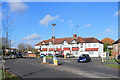
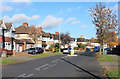
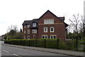
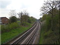
39 photos from this area
Area Information
Key information about the HA4 6HS including its size, population, and administrative classification.
- Area Type
- Postcode
- Area Size
- 6701 m²
- Population
- 1604
- Population Density
- 4345 people/km²
House Prices in HA4 6HS
15
Properties
£371,146
Average Sold Price
£90,000
Lowest Price
£600,000
Highest Price
Showing 15 properties
| Address | Type | Beds | Baths | Last Sale Price | Last Sale Date | |
|---|---|---|---|---|---|---|
| 157 Herlwyn Avenue, Ruislip, HA4 6HS | Bungalow | 2 | 1 | £550,000 | Nov 2025 | |
| 145 Herlwyn Avenue, Ruislip, HA4 6HS | Bungalow | 2 | 1 | £385,000 | Mar 2025 | |
| 159 Herlwyn Avenue, Ruislip, HA4 6HS | Bungalow | 2 | 1 | £600,000 | Mar 2023 | |
| 153 Herlwyn Avenue, Ruislip, HA4 6HS | Bungalow | - | - | £585,000 | Mar 2021 | |
| 131 Herlwyn Avenue, Ruislip, HA4 6HS | Bungalow | 4 | 3 | £580,000 | Dec 2019 | |
| 143 Herlwyn Avenue, Ruislip, HA4 6HS | Semi-detached | 3 | 1 | £462,000 | Nov 2017 | |
| 141 Herlwyn Avenue, Ruislip, HA4 6HS | Semi-detached | 3 | 2 | £420,000 | Nov 2014 | |
| 147 Herlwyn Avenue, Ruislip, HA4 6HS | Bungalow | - | - | £249,950 | Oct 2009 | |
| 151 Herlwyn Avenue, Ruislip, HA4 6HS | Bungalow | - | - | £289,950 | Apr 2007 | |
| 139 Herlwyn Avenue, Ruislip, HA4 6HS | Semi-detached | - | - | £250,000 | Nov 2003 |
Page 1 of 2
Energy Efficiency in HA4 6HS
Amenities
Schools
| Rank | School | Type | Entry gender | Ages |
|---|
Explore more schools in this area
Go to Schools tabDemographics
Household Size
Family (3-5 people)
most common
Accommodation Type
Houses
most common
Tenure
88
majority
Ethnic Group
White
most common
Religion
N/A
most common
Household Composition
N/A
most common
Age
47
median
Adults (30-64 years)
most common
Household Deprivation
N/A
with no deprivation
NS-SEC
42
in Lower managerial occupations
Explore more demographic insights in this area
Go to Demographics tabPlanning
Planning Constraints
- Flood RiskPremium
- Ramsar Wetland SitesPremium
- Area of Outstanding Natural BeautyPremium
- Protected Nature ReservePremium
- Protected WoodlandPremium