Area Overview for HA4 0RZ
Photos of HA4 0RZ
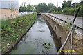
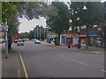
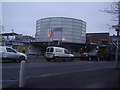
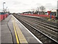
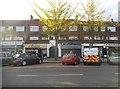
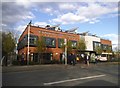
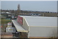
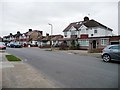
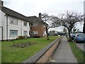
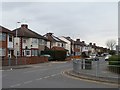
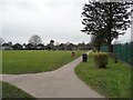
93 photos from this area
Area Information
Key information about the HA4 0RZ including its size, population, and administrative classification.
- Area Type
- Postcode
- Area Size
- 8608 m²
- Population
- 1414
- Population Density
- 3572 people/km²
House Prices in HA4 0RZ
29
Properties
£456,872
Average Sold Price
£125,000
Lowest Price
£860,000
Highest Price
Showing 29 properties
| Address | Type | Beds | Baths | Last Sale Price | Last Sale Date | |
|---|---|---|---|---|---|---|
| 25 Angus Drive, Ruislip, HA4 0RZ | house | 3 | 1 | £650,000 | Nov 2025 | |
| 31 Angus Drive, Ruislip, HA4 0RZ | Semi-detached | 3 | 1 | £575,000 | Mar 2025 | |
| 17 Angus Drive, Ruislip, HA4 0RZ | Semi-detached | 4 | 3 | £700,000 | Jan 2025 | |
| 11 Angus Drive, Ruislip, HA4 0RZ | Semi-detached | 3 | 2 | £657,500 | Aug 2022 | |
| 41 Angus Drive, Ruislip, HA4 0RZ | house | 3 | - | £860,000 | Jul 2022 | |
| 27 Angus Drive, Ruislip, HA4 0RZ | house | - | - | £651,000 | Sep 2021 | |
| 51 Angus Drive, Ruislip, HA4 0RZ | Semi-detached | 3 | - | £542,000 | Feb 2018 | |
| 57 Angus Drive, Ruislip, HA4 0RZ | Flat | - | - | £190,000 | Dec 2016 | |
| 33 Angus Drive, Ruislip, HA4 0RZ | Semi-detached | 5 | - | £610,000 | Feb 2016 | |
| 21 Angus Drive, Ruislip, HA4 0RZ | Semi-detached | 4 | 2 | £495,000 | Nov 2014 |
Page 1 of 3
Energy Efficiency in HA4 0RZ
Amenities
Schools
| Rank | School | Type | Entry gender | Ages |
|---|
Explore more schools in this area
Go to Schools tabDemographics
Household Size
Family (3-5 people)
most common
Accommodation Type
Houses
most common
Tenure
81
majority
Ethnic Group
White
most common
Religion
N/A
most common
Household Composition
N/A
most common
Age
47
median
Adults (30-64 years)
most common
Household Deprivation
N/A
with no deprivation
NS-SEC
41
in Lower managerial occupations
Explore more demographic insights in this area
Go to Demographics tabPlanning
Planning Constraints
- Flood RiskPremium
- Ramsar Wetland SitesPremium
- Area of Outstanding Natural BeautyPremium
- Protected Nature ReservePremium
- Protected WoodlandPremium