Area Overview for HA3 8SZ
Photos of HA3 8SZ


Area Information
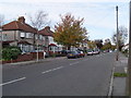
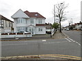
HA3 8SZ is a compact residential postcode in England, covering just 1.3 hectares and home to 1,478 residents. Its small size means it’s a tightly knit community, with a population density of 113,464 people per square kilometre. This area is characterised by its predominantly owner-occupied housing stock, with 75% of homes owned by residents rather than rented. The median age of 47 suggests a mature population, with the majority of residents falling within the 30–64 age range. Daily life here is shaped by proximity to essential services, including multiple primary schools and retail outlets. The area’s safety profile is strong, with a low crime risk score of 82 and no flood or environmental hazards. Living in HA3 8SZ offers a blend of practicality and stability, with homes primarily in single-family properties and a community that values security and accessibility.
- Area Type
- Postcode
- Area Size
- 1.3 hectares
- Population
- 1478
- Population Density
- 7238 people/km²
HA3 8SZ is a predominantly owner-occupied area, with 75% of homes owned by residents. The housing stock is almost entirely composed of houses, which is notable in a postcode of this size. This suggests a focus on family homes rather than flats or apartments, appealing to those seeking space and privacy. The small area means the property market is limited in scope, with few options available. Buyers should consider the proximity to schools, transport links, and retail hubs, which are all within practical reach. The high home ownership rate indicates a stable market, with properties likely to retain value due to low environmental risks and safety. For those seeking a home in HA3 8SZ, the emphasis on houses and owner-occupation makes it a niche but practical choice for families and long-term residents.
House Prices in HA3 8SZ
Showing 1 properties
| Address | Type | Beds | Baths | Last Sale Price | Last Sale Date | |
|---|---|---|---|---|---|---|
| Salvatorian College At Priestmead Site, Hartford Avenue, Kenton, HA3 8SZ | commercial | - | - | - | - |
Energy Efficiency in HA3 8SZ
Living in HA3 8SZ offers a range of amenities within easy reach. Retail options include major stores such as Tesco Harrow, Asda Belmont, and Asda Wealdstone, providing convenience for shopping and daily errands. The area’s transport links mean residents can access broader leisure and cultural opportunities beyond the immediate postcode. The presence of multiple rail and metro stations, including Harrow & Wealdstone and Northwick Park, ensures easy access to urban centres. While the area itself is small, its proximity to larger hubs means residents can enjoy a balance between local convenience and wider connectivity. The compact size of HA3 8SZ means amenities are not distant, fostering a practical lifestyle with minimal travel time.
Amenities
Schools
Residents of HA3 8SZ have access to three primary schools, all named Priestmead Primary School and Nursery. Two of these are explicitly listed as primary schools, while one holds an outstanding Ofsted rating. This concentration of primary education options is a significant advantage for families, ensuring multiple choices for schooling. The presence of an outstanding-rated school suggests high standards in education, which can be a decisive factor for homebuyers prioritising schools. The proximity of these institutions to homes in HA3 8SZ means parents can easily access drop-offs and pickups. The mix of schools, though limited in variety, ensures that children receive a consistent educational foundation within the local community.
| Rank | School | Type | Entry gender | Ages |
|---|
Explore more schools in this area
Go to Schools tabDemographics
The population of HA3 8SZ is predominantly adults aged 30–64, reflecting a mature demographic with a median age of 47. Home ownership is high at 75%, indicating a community of long-term residents rather than transient renters. The accommodation type is primarily houses, which is unusual for areas with higher density. The predominant ethnic group is Asian_total, which shapes the cultural fabric of the area. This demographic profile suggests a stable, family-oriented population with established roots. The absence of specific deprivation data means the quality of life can be inferred from the low crime risk and access to amenities. Residents here are likely to prioritise security, community ties, and proximity to services. The area’s compact size ensures that daily needs are met locally, reinforcing a sense of cohesion among its inhabitants.
Household Size
Accommodation Type
Tenure
Ethnic Group
Religion
Household Composition
Age
Household Deprivation
NS-SEC
Explore more demographic insights in this area
Go to Demographics tabPlanning
Planning Constraints
- Flood RiskPremium
- Ramsar Wetland SitesPremium
- Area of Outstanding Natural BeautyPremium
- Protected Nature ReservePremium
- Protected WoodlandPremium