Area Overview for HA2 7EF
Photos of HA2 7EF
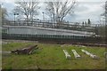
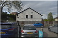
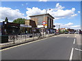
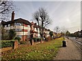
51 photos from this area
Area Information
Key information about the HA2 7EF including its size, population, and administrative classification.
- Area Type
- Postcode
- Area Size
- 6602 m²
- Population
- 1936
- Population Density
- 5372 people/km²
House Prices in HA2 7EF
17
Properties
£376,000
Average Sold Price
£295,500
Lowest Price
£600,000
Highest Price
Showing 17 properties
| Address | Type | Beds | Baths | Last Sale Price | Last Sale Date | |
|---|---|---|---|---|---|---|
| 28 Alfriston Avenue, North Harrow, HA2 7EF | Retail | 3 | 1 | £600,000 | Feb 2022 | |
| 36 Alfriston Avenue, North Harrow, HA2 7EF | house | 3 | 1 | £364,000 | Jan 2011 | |
| 18 Alfriston Avenue, North Harrow, HA2 7EF | Semi-detached | - | - | £385,000 | Sep 2007 | |
| 22 Alfriston Avenue, North Harrow, HA2 7EF | Detached | 3 | 1 | £314,000 | Feb 2006 | |
| 26 Alfriston Avenue, North Harrow, HA2 7EF | Terraced | - | - | £295,500 | Feb 2006 | |
| 50 Alfriston Avenue, North Harrow, HA2 7EF | Terraced | - | - | £322,500 | Jun 2004 | |
| 44 Alfriston Avenue, North Harrow, HA2 7EF | Terraced | - | - | £351,000 | Apr 2004 | |
| 24 Alfriston Avenue, North Harrow, HA2 7EF | Semi-detached | 3 | - | - | - | |
| 40 Alfriston Avenue, North Harrow, HA2 7EF | Terraced | - | - | - | - | |
| 20 Alfriston Avenue, North Harrow, HA2 7EF | Semi-detached | - | - | - | - |
Page 1 of 2
Energy Efficiency in HA2 7EF
Amenities
Schools
| Rank | School | Type | Entry gender | Ages |
|---|
Explore more schools in this area
Go to Schools tabDemographics
Household Size
Family (3-5 people)
most common
Accommodation Type
Houses
most common
Tenure
62
majority
Ethnic Group
asian_total
most common
Religion
N/A
most common
Household Composition
N/A
most common
Age
47
median
Adults (30-64 years)
most common
Household Deprivation
N/A
with no deprivation
NS-SEC
44
in Lower managerial occupations
Explore more demographic insights in this area
Go to Demographics tabPlanning
Planning Constraints
- Flood RiskPremium
- Ramsar Wetland SitesPremium
- Area of Outstanding Natural BeautyPremium
- Protected Nature ReservePremium
- Protected WoodlandPremium