Area Overview for HA2 0PY
Photos of HA2 0PY

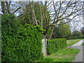


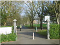
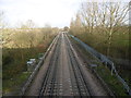

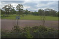

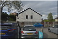
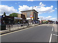
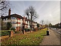
51 photos from this area
Area Information
Key information about the HA2 0PY including its size, population, and administrative classification.
- Area Type
- Postcode
- Area Size
- 1.1 hectares
- Population
- 1610
- Population Density
- 10960 people/km²
House Prices in HA2 0PY
42
Properties
£294,530
Average Sold Price
£60,000
Lowest Price
£625,000
Highest Price
Showing 42 properties
| Address | Type | Beds | Baths | Last Sale Price | Last Sale Date | |
|---|---|---|---|---|---|---|
| 177 Abercorn Crescent, South Harrow, HA2 0PY | Terraced | 3 | 1 | £545,000 | Sep 2025 | |
| 163 Abercorn Crescent, South Harrow, HA2 0PY | Terraced | 3 | 1 | £505,000 | Feb 2025 | |
| 131 Abercorn Crescent, South Harrow, HA2 0PY | Terraced | 3 | 1 | £625,000 | Nov 2024 | |
| 119 Abercorn Crescent, South Harrow, HA2 0PY | Terraced | 3 | 1 | £555,000 | Oct 2024 | |
| 133 Abercorn Crescent, South Harrow, HA2 0PY | Terraced | 3 | 1 | £442,000 | Nov 2020 | |
| 155 Abercorn Crescent, South Harrow, HA2 0PY | Terraced | 4 | 2 | £510,000 | Aug 2020 | |
| 113 Abercorn Crescent, South Harrow, HA2 0PY | Terraced | 3 | 1 | £500,000 | Jun 2019 | |
| 135 Abercorn Crescent, South Harrow, HA2 0PY | house | - | - | £450,000 | Apr 2018 | |
| 173 Abercorn Crescent, South Harrow, HA2 0PY | Terraced | 3 | 1 | £440,000 | Sep 2017 | |
| 171 Abercorn Crescent, South Harrow, HA2 0PY | Semi-detached | 3 | 1 | £452,000 | Mar 2016 |
Page 1 of 5
Energy Efficiency in HA2 0PY
Amenities
Schools
| Rank | School | Type | Entry gender | Ages |
|---|
Explore more schools in this area
Go to Schools tabDemographics
Household Size
Family (3-5 people)
most common
Accommodation Type
Houses
most common
Tenure
63
majority
Ethnic Group
asian_total
most common
Religion
N/A
most common
Household Composition
N/A
most common
Age
47
median
Adults (30-64 years)
most common
Household Deprivation
N/A
with no deprivation
NS-SEC
31
in Lower managerial occupations
Explore more demographic insights in this area
Go to Demographics tabPlanning
Planning Constraints
- Flood RiskPremium
- Ramsar Wetland SitesPremium
- Area of Outstanding Natural BeautyPremium
- Protected Nature ReservePremium
- Protected WoodlandPremium