Area Overview for HA2 0PF
Photos of HA2 0PF
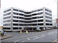

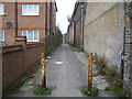

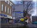


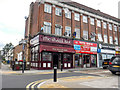

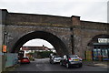
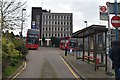

91 photos from this area
Area Information
Key information about the HA2 0PF including its size, population, and administrative classification.
- Area Type
- Postcode
- Area Size
- 6376 m²
- Population
- 1610
- Population Density
- 10960 people/km²
House Prices in HA2 0PF
18
Properties
£175,957
Average Sold Price
£68,000
Lowest Price
£284,950
Highest Price
Showing 18 properties
| Address | Type | Beds | Baths | Last Sale Price | Last Sale Date | |
|---|---|---|---|---|---|---|
| 2 Franklins Mews, Harrow On The Hill, HA2 0PF | house | 3 | 1 | £284,950 | Sep 2013 | |
| 15 Franklins Mews, Harrow On The Hill, HA2 0PF | Terraced | 3 | 1 | £260,000 | Nov 2012 | |
| 6 Franklins Mews, Harrow On The Hill, HA2 0PF | house | 2 | - | £248,000 | Mar 2012 | |
| 12 Franklins Mews, Harrow On The Hill, HA2 0PF | house | - | - | £250,000 | Jun 2010 | |
| 9 Franklins Mews, Harrow On The Hill, HA2 0PF | Terraced | 3 | 1 | £283,000 | Aug 2007 | |
| 7 Franklins Mews, Harrow On The Hill, HA2 0PF | Maisonette | 2 | 1 | £183,000 | Nov 2006 | |
| 8 Franklins Mews, Harrow On The Hill, HA2 0PF | Flat | - | - | £164,950 | Dec 2005 | |
| 16 Franklins Mews, Harrow On The Hill, HA2 0PF | Terraced | - | - | £228,000 | May 2004 | |
| 14 Franklins Mews, Harrow On The Hill, HA2 0PF | Terraced | 3 | 1 | £139,000 | Jan 2000 | |
| 10 Franklins Mews, Harrow On The Hill, HA2 0PF | Terraced | - | - | £109,000 | May 1998 |
Page 1 of 2
Energy Efficiency in HA2 0PF
Amenities
Schools
| Rank | School | Type | Entry gender | Ages |
|---|
Explore more schools in this area
Go to Schools tabDemographics
Household Size
Family (3-5 people)
most common
Accommodation Type
Houses
most common
Tenure
63
majority
Ethnic Group
asian_total
most common
Religion
N/A
most common
Household Composition
N/A
most common
Age
47
median
Adults (30-64 years)
most common
Household Deprivation
N/A
with no deprivation
NS-SEC
31
in Lower managerial occupations
Explore more demographic insights in this area
Go to Demographics tabPlanning
Planning Constraints
- Flood RiskPremium
- Ramsar Wetland SitesPremium
- Area of Outstanding Natural BeautyPremium
- Protected Nature ReservePremium
- Protected WoodlandPremium