Area Overview for HA2 8UR
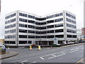
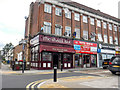
Photos of HA2 8UR


Area Information
HA2 8UR is a small residential postcode in England, home to around 1971 people. It is a compact area where daily life is shaped by its proximity to retail hubs, transport links, and a mix of urban and suburban character. The community here is defined by its adult population, with most residents aged between 30 and 64. This suggests a stable, established demographic, likely with families and professionals. The area’s housing stock is dominated by flats, reflecting its density and the practicality of such accommodation in a smaller postcode. Living here means being near multiple supermarkets like Waitrose South and Tesco Harrow, as well as train stations such as South Harrow and Rayners Lane, which provide easy access to London. The presence of RAF Northolt nearby adds a unique layer to the area’s profile. While it is not a sprawling suburb, HA2 8UR offers a blend of convenience and connectivity, appealing to those seeking a balance between urban amenities and a quieter residential setting.
- Area Type
- Postcode
- Area Size
- Not available
- Population
- 1971
- Population Density
- 15831 people/km²
The property market in HA2 8UR is characterised by a high concentration of flats, which dominate the housing stock. With only 38% of homes owned by residents, the area leans more towards rental properties than owner-occupied residences. This suggests a dynamic market where demand for flats may be driven by affordability or proximity to transport links. The small postcode size means the available housing is limited, and buyers should consider the surrounding areas for more options. The prevalence of flats may appeal to those seeking lower maintenance costs or easier access to public transport. However, the lack of data on property prices or recent trends means potential buyers must rely on local agents for up-to-date insights. The market is likely to cater to professionals and families prioritising convenience over large homes.
House Prices in HA2 8UR
No properties found in this postcode.
Energy Efficiency in HA2 8UR
HA2 8UR offers a range of amenities within practical reach, enhancing daily life for residents. The area is close to major supermarkets such as Waitrose South, Tesco Harrow, and Iceland South, ensuring easy access to groceries and everyday essentials. Multiple train stations, including South Harrow, West Harrow, and Rayners Lane, provide frequent services to London and beyond, supporting both commuters and those who travel for leisure. The presence of RAF Northolt nearby may offer unique recreational or event opportunities, though civilian amenities are not detailed in the data. The mix of retail and transport options suggests a convenient, functional lifestyle, ideal for those prioritising accessibility over sprawling green spaces. While the area lacks explicit references to parks or leisure facilities, its proximity to major hubs compensates with urban convenience.
Amenities
Schools
| Rank | School | Type | Entry gender | Ages |
|---|
Explore more schools in this area
Go to Schools tabDemographics
The population of HA2 8UR has a median age of 47, with the majority of residents falling into the 30–64 age range. This indicates a community of working-age adults, likely with established careers and families. Home ownership is relatively low at 38%, suggesting a higher proportion of renters, which may reflect the dominance of flats in the area. The predominant ethnic group is Asian, though specific subgroups are not detailed. This diversity contributes to the area’s cultural fabric. The absence of data on deprivation means no direct conclusions can be drawn about economic hardship, but the age profile and ownership rates suggest a mix of long-term residents and those in transient housing situations. The community is likely to be stable, with a focus on practical living rather than high-end property or luxury amenities.
Household Size
Accommodation Type
Tenure
Ethnic Group
Religion
Household Composition
Age
Household Deprivation
NS-SEC
Explore more demographic insights in this area
Go to Demographics tabPlanning
Planning Constraints
- Flood RiskPremium
- Ramsar Wetland SitesPremium
- Area of Outstanding Natural BeautyPremium
- Protected Nature ReservePremium
- Protected WoodlandPremium