Area Overview for HA2 0AA
Photos of HA2 0AA
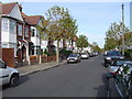
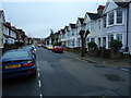
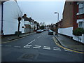
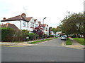
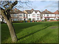
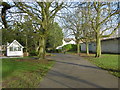
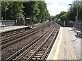
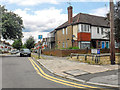
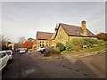
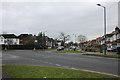
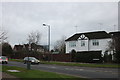

61 photos from this area
Area Information
Key information about the HA2 0AA including its size, population, and administrative classification.
- Area Type
- Postcode
- Area Size
- 1.2 hectares
- Population
- 2031
- Population Density
- 5473 people/km²
House Prices in HA2 0AA
28
Properties
£334,596
Average Sold Price
£97,000
Lowest Price
£550,000
Highest Price
Showing 28 properties
| Address | Type | Beds | Baths | Last Sale Price | Last Sale Date | |
|---|---|---|---|---|---|---|
| 41 Merton Road, West Harrow, HA2 0AA | Semi-detached | 2 | 1 | £502,500 | Jan 2024 | |
| 29 Merton Road, West Harrow, HA2 0AA | house | - | - | £550,000 | Oct 2022 | |
| 51 Merton Road, West Harrow, HA2 0AA | Semi-detached | 3 | 1 | £550,000 | Jun 2022 | |
| 19 Merton Road, West Harrow, HA2 0AA | Semi-detached | 2 | 1 | £427,500 | Jul 2020 | |
| 39 Merton Road, West Harrow, HA2 0AA | Bungalow | 2 | 1 | £495,000 | Aug 2019 | |
| 5 Merton Road, West Harrow, HA2 0AA | Bungalow | 3 | 2 | £470,000 | May 2019 | |
| 23 Merton Road, West Harrow, HA2 0AA | house | - | - | £518,000 | Dec 2018 | |
| 15 Merton Road, West Harrow, HA2 0AA | Bungalow | - | - | £470,000 | Oct 2017 | |
| 9 Merton Road, West Harrow, HA2 0AA | Semi-detached | 3 | 2 | £478,000 | Aug 2017 | |
| 33 Merton Road, West Harrow, HA2 0AA | Bungalow | 2 | 1 | £275,000 | Dec 2012 |
Page 1 of 3
Energy Efficiency in HA2 0AA
Amenities
Schools
| Rank | School | Type | Entry gender | Ages |
|---|
Explore more schools in this area
Go to Schools tabDemographics
Household Size
Family (3-5 people)
most common
Accommodation Type
Houses
most common
Tenure
58
majority
Ethnic Group
White
most common
Religion
N/A
most common
Household Composition
N/A
most common
Age
47
median
Adults (30-64 years)
most common
Household Deprivation
N/A
with no deprivation
NS-SEC
36
in Lower managerial occupations
Explore more demographic insights in this area
Go to Demographics tabPlanning
Planning Constraints
- Flood RiskPremium
- Ramsar Wetland SitesPremium
- Area of Outstanding Natural BeautyPremium
- Protected Nature ReservePremium
- Protected WoodlandPremium