Area Overview for HA1 4NE
Photos of HA1 4NE

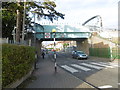
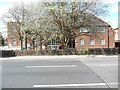
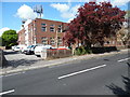
98 photos from this area
Area Information
Key information about the HA1 4NE including its size, population, and administrative classification.
- Area Type
- Postcode
- Area Size
- 6832 m²
- Population
- 1929
- Population Density
- 8286 people/km²
House Prices in HA1 4NE
29
Properties
£240,850
Average Sold Price
£40,500
Lowest Price
£537,500
Highest Price
Showing 29 properties
| Address | Type | Beds | Baths | Last Sale Price | Last Sale Date | |
|---|---|---|---|---|---|---|
| 54A Cornwall Road, Harrow, HA1 4NE | Flat | 1 | 1 | £190,000 | Jan 2024 | |
| 20 Cornwall Road, Harrow, HA1 4NE | Terraced | 3 | 1 | £464,500 | Sep 2020 | |
| 16 Cornwall Road, Harrow, HA1 4NE | Terraced | 3 | 1 | £510,000 | Oct 2019 | |
| 42 Cornwall Road, Harrow, HA1 4NE | Terraced | 3 | 1 | £537,500 | Jun 2018 | |
| 6B Cornwall Road, Harrow, HA1 4NE | Flat | - | - | £208,950 | Mar 2015 | |
| 50 Cornwall Road, Harrow, HA1 4NE | Terraced | 4 | - | £380,000 | Jun 2013 | |
| 10 Cornwall Road, Harrow, HA1 4NE | house | 3 | - | £335,000 | Jan 2011 | |
| 44 Cornwall Road, Harrow, HA1 4NE | house | 3 | - | £250,000 | Oct 2006 | |
| 24 Cornwall Road, Harrow, HA1 4NE | Terraced | - | - | £276,000 | Aug 2005 | |
| 34 Cornwall Road, Harrow, HA1 4NE | Terraced | 3 | - | £245,000 | Jan 2005 |
Page 1 of 3
Energy Efficiency in HA1 4NE
Amenities
Schools
| Rank | School | Type | Entry gender | Ages |
|---|
Explore more schools in this area
Go to Schools tabDemographics
Household Size
Family (3-5 people)
most common
Accommodation Type
Houses
most common
Tenure
66
majority
Ethnic Group
asian_total
most common
Religion
N/A
most common
Household Composition
N/A
most common
Age
47
median
Adults (30-64 years)
most common
Household Deprivation
N/A
with no deprivation
NS-SEC
41
in Lower managerial occupations
Explore more demographic insights in this area
Go to Demographics tabPlanning
Planning Constraints
- Flood RiskPremium
- Ramsar Wetland SitesPremium
- Area of Outstanding Natural BeautyPremium
- Protected Nature ReservePremium
- Protected WoodlandPremium