Area Overview for HA1 4LF
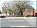
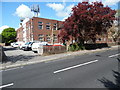
Photos of HA1 4LF


Area Information
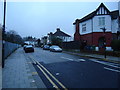
HA1 4LF is a small residential postcode area in England, home to 2,475 people. It is a compact cluster of properties, primarily flats, catering to a community of adults aged 30–64, with a median age of 47. The area’s modest size means residents are likely to know their neighbours, though the population density is low enough to avoid overcrowding. Proximity to transport hubs like West Harrow Station and Rayners Lane Station makes commuting straightforward, while nearby amenities such as Tesco Harrow and Morrisons Harrow provide daily shopping convenience. The presence of Khalsa College London, an independent school, suggests the area attracts families seeking private education. Despite its small footprint, HA1 4LF balances residential comfort with access to urban infrastructure, offering a quieter alternative to larger towns while retaining connectivity to London’s broader network.
- Area Type
- Postcode
- Area Size
- Not available
- Population
- 2475
- Population Density
- 8179 people/km²
HA1 4LF’s property market is characterised by a high proportion of flats, with 42% of residents owning their homes. This suggests the area is more rental-oriented than owner-occupied, though the exact balance between buy-to-let and long-term ownership is unclear. The prevalence of flats may appeal to those seeking lower maintenance costs or easier access to transport links. Given the small population and limited housing stock, the market is likely tight, with limited scope for expansion. Buyers should consider the area’s compact nature and its suitability for those prioritising proximity to amenities over larger living spaces. The focus on flats also means property values may be influenced more by location and transport access than by square footage.
House Prices in HA1 4LF
Showing 3 properties
| Address | Type | Beds | Baths | Last Sale Price | Last Sale Date | |
|---|---|---|---|---|---|---|
| Flat 45, Hockney House, 20 Hetherington Street, Harrow, HA1 4LF | Flat | 2 | 2 | - | - | |
| Flat 2, Hockney House, 20 Hetherington Street, Harrow, HA1 4LF | Flat | 2 | 2 | - | - | |
| Flat 1, Hockney House, 20 Hetherington Street, Harrow, HA1 4LF | Flat | 1 | 1 | - | - |
Energy Efficiency in HA1 4LF
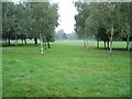
HA1 4LF’s lifestyle is shaped by its proximity to retail and transport hubs. Tesco Harrow, Morrisons Harrow, and other local stores offer everyday shopping, while the nearby stations provide access to dining, leisure, and employment opportunities beyond the postcode. The area’s limited green spaces are offset by its ease of access to larger parks and recreational areas via public transport. The presence of RAF Northolt may introduce a unique character to the community, though its impact on daily life is not detailed. Overall, the area’s convenience and connectivity make it practical for those prioritising accessibility over expansive natural amenities.
Amenities
Schools
The nearest school to HA1 4LF is Khalsa College London, an independent institution. While no Ofsted rating is provided, its status as an independent school may indicate higher fees and selective admission. The lack of state schools in the immediate vicinity suggests families in HA1 4LF may need to look beyond the postcode for public education options. This could be a consideration for those prioritising affordability or seeking a broader range of school types. The presence of a single independent school highlights the area’s appeal to families with specific educational preferences, though it also underscores the limited local school infrastructure.
| Rank | School | Type | Entry gender | Ages |
|---|
Explore more schools in this area
Go to Schools tabDemographics
The population of HA1 4LF is predominantly adults aged 30–64, with a median age of 47. Only 42% of residents own their homes, indicating a significant proportion of renters, which may reflect the area’s focus on flats rather than detached housing. The accommodation type is overwhelmingly flats, aligning with the lower home ownership rate. The predominant ethnic group is Asian, though specific subgroups are not detailed. This demographic profile suggests a stable, mature community with established households. The absence of data on deprivation levels means no direct assessment of quality of life factors like income or access to services can be made, but the presence of nearby schools and retail options implies basic needs are met.
Household Size
Accommodation Type
Tenure
Ethnic Group
Religion
Household Composition
Age
Household Deprivation
NS-SEC
Explore more demographic insights in this area
Go to Demographics tabPlanning
Planning Constraints
- Flood RiskPremium
- Ramsar Wetland SitesPremium
- Area of Outstanding Natural BeautyPremium
- Protected Nature ReservePremium
- Protected WoodlandPremium