Area Overview for HA1 3RJ
Photos of HA1 3RJ
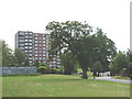
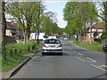
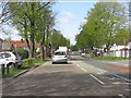
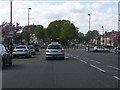
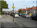
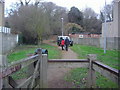
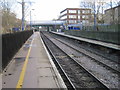
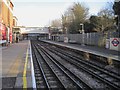
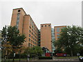
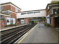
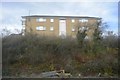
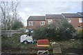
65 photos from this area
Area Information
Key information about the HA1 3RJ including its size, population, and administrative classification.
- Area Type
- Postcode
- Area Size
- 5664 m²
- Population
- 2015
- Population Density
- 4787 people/km²
House Prices in HA1 3RJ
59
Properties
£220,082
Average Sold Price
£124,950
Lowest Price
£410,000
Highest Price
Showing 59 properties
| Address | Type | Beds | Baths | Last Sale Price | Last Sale Date | |
|---|---|---|---|---|---|---|
| 10 Hartington Close, Sudbury, HA1 3RJ | Flat | - | - | £225,000 | Nov 2019 | |
| 13 Hartington Close, Sudbury, HA1 3RJ | Flat | 1 | 1 | £249,950 | Oct 2018 | |
| 6 Hartington Close, Sudbury, HA1 3RJ | Flat | - | - | £263,000 | Aug 2018 | |
| 30 Hartington Close, Sudbury, HA1 3RJ | Terraced | 3 | - | £410,000 | Aug 2017 | |
| 15 Hartington Close, Sudbury, HA1 3RJ | Flat | - | - | £252,000 | Jun 2017 | |
| 20 Hartington Close, Sudbury, HA1 3RJ | Flat | - | - | £155,000 | Dec 2012 | |
| 29 Hartington Close, Sudbury, HA1 3RJ | house | - | - | £223,500 | May 2009 | |
| 28 Hartington Close, Sudbury, HA1 3RJ | house | - | - | £224,000 | Mar 2008 | |
| 11 Hartington Close, Sudbury, HA1 3RJ | Flat | - | - | £166,500 | Sep 2007 | |
| 24 Hartington Close, Sudbury, HA1 3RJ | Flat | 1 | 1 | £127,000 | Sep 2003 |
Page 1 of 6
Energy Efficiency in HA1 3RJ
Amenities
Schools
| Rank | School | Type | Entry gender | Ages |
|---|
Explore more schools in this area
Go to Schools tabDemographics
Household Size
Family (3-5 people)
most common
Accommodation Type
Flats
most common
Tenure
53
majority
Ethnic Group
asian_total
most common
Religion
N/A
most common
Household Composition
N/A
most common
Age
47
median
Adults (30-64 years)
most common
Household Deprivation
N/A
with no deprivation
NS-SEC
31
in Lower managerial occupations
Explore more demographic insights in this area
Go to Demographics tabPlanning
Planning Constraints
- Flood RiskPremium
- Ramsar Wetland SitesPremium
- Area of Outstanding Natural BeautyPremium
- Protected Nature ReservePremium
- Protected WoodlandPremium