Area Overview for HA0 2ES
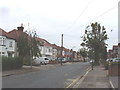
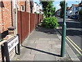
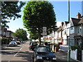
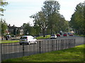
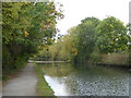
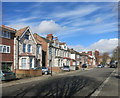
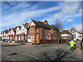
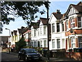
Photos of HA0 2ES


Area Information
HA0 2ES is a small, densely populated residential cluster in England, covering just 5,849 square metres and home to 1,766 residents. With a population density of 301,921 people per square kilometre, this area is compact yet highly populated, suggesting a mix of close-knit living and limited space for expansion. The community is predominantly composed of adults aged 30–64, with a median age of 47, indicating a mature, established demographic. The area’s housing stock is largely composed of houses, though home ownership rates are relatively low at 45%, suggesting a significant proportion of residents rent. The postcode is served by Barham Primary School, which holds a ‘good’ Ofsted rating, and is within reach of multiple transport hubs, including Sudbury Town Station and Wembley Central Station. Daily life here is shaped by proximity to retail outlets like Tesco Sudbury and rail links, while the area’s safety profile—marked by a crime score of 74—offers reassurance for families and professionals. Despite its small size, HA0 2ES balances density with accessibility, making it a practical choice for those prioritising connectivity over space.
- Area Type
- Postcode
- Area Size
- 5849 m²
- Population
- 1766
- Population Density
- 6901 people/km²
HA0 2ES is characterised by a housing stock dominated by houses, though home ownership rates are modest at 45%, indicating a strong rental market. This suggests that the area’s limited size and high density may make it more suitable for renters than buyers, particularly for those seeking larger properties. The absence of flats or apartments in the data implies a lack of high-density housing, which could limit options for those prioritising affordability or space. Given the area’s small footprint, the property market is likely constrained, with limited scope for new developments. Buyers should consider the proximity to transport links and amenities, though competition for existing homes may be fierce. The low flood risk and absence of planning constraints like AONB or protected nature reserves also make it a practical choice for those seeking a stable, low-risk investment. However, the small size of HA0 2ES means buyers must weigh the benefits of its connectivity against the potential limitations of its physical boundaries.
House Prices in HA0 2ES
Showing 15 properties
| Address | Type | Beds | Baths | Last Sale Price | Last Sale Date | |
|---|---|---|---|---|---|---|
| 18 Linthorpe Avenue, Wembley, HA0 2ES | Bungalow | 2 | 1 | £510,000 | Mar 2024 | |
| 24 Linthorpe Avenue, Wembley, HA0 2ES | Retail | 2 | 1 | £520,000 | Mar 2022 | |
| 20 Linthorpe Avenue, Wembley, HA0 2ES | Retail | 2 | 1 | £475,000 | Feb 2022 | |
| 22 Linthorpe Avenue, Wembley, HA0 2ES | Bungalow | - | - | £505,000 | Dec 2020 | |
| 26 Linthorpe Avenue, Wembley, HA0 2ES | Bungalow | - | - | £470,000 | Dec 2018 | |
| 28 Linthorpe Avenue, Wembley, HA0 2ES | Bungalow | 2 | 1 | £387,000 | Jan 2016 | |
| 30 Linthorpe Avenue, Wembley, HA0 2ES | Bungalow | 2 | 1 | £335,000 | May 2014 | |
| 16 Linthorpe Avenue, Wembley, HA0 2ES | Bungalow | 2 | - | £260,000 | Mar 2012 | |
| 2 Linthorpe Avenue, Wembley, HA0 2ES | Bungalow | 3 | - | £330,000 | Oct 2010 | |
| 8 Linthorpe Avenue, Wembley, HA0 2ES | house | - | - | £110,000 | Oct 1998 |
Energy Efficiency in HA0 2ES
Living in HA0 2ES offers access to a range of amenities within practical reach. The area is served by five retail outlets, including Tesco Sudbury and Iceland Wembley, providing everyday shopping options. Metro stations like Sudbury Town and Alperton, along with rail links such as Wembley Central, ensure easy access to public transport. For leisure, the nearby Little Venice Waterbus Stop and Kew Pier offer waterfront activities, while RAF Northolt provides a unique local landmark. The presence of multiple transport hubs and retail spots suggests a convenient lifestyle, though the small postcode size means some amenities may be concentrated in adjacent areas. The area’s proximity to schools, transport, and retail creates a functional environment, though the lack of parks or green spaces is not mentioned in the data. Overall, HA0 2ES balances practicality with connectivity, making it suitable for those prioritising accessibility over expansive recreational options.
Amenities
Schools
The nearest school to HA0 2ES is Barham Primary School, a primary institution with a ‘good’ Ofsted rating. This provides a reliable option for families with young children, though no secondary schools are listed in the data, meaning older students may need to travel further afield. The presence of a primary school with a positive rating is a clear advantage for families prioritising education, but the lack of secondary options could be a drawback for those requiring a full range of schooling within the area. The school’s proximity to the postcode suggests it is a key local institution, though its capacity and catchment area are not specified. For parents, this means the area is suitable for early education but may require additional planning for secondary schooling. The absence of other educational facilities in the data highlights the need to assess commuting options for older children.
| Rank | School | Type | Entry gender | Ages |
|---|
Explore more schools in this area
Go to Schools tabDemographics
The population of HA0 2ES skews towards adults aged 30–64, with a median age of 47. This suggests a community of working-age individuals and families, though the absence of data on younger or older demographics means the full age spectrum remains unclear. Home ownership is at 45%, indicating that over half of residents are renters, which could reflect the area’s limited housing stock or rental market dynamics. The predominant ethnic group is Asian_total, though no further breakdown of diversity is provided. The high population density—301,921 people per square kilometre—raises questions about living standards, though it also implies a well-established, tightly packed community. While no deprivation data is available, the low crime score of 74 and absence of environmental constraints like protected woodlands or wetlands suggest a relatively stable quality of life. However, the lack of secondary schools and limited housing options may pose challenges for growing families or those seeking long-term residency.
Household Size
Accommodation Type
Tenure
Ethnic Group
Religion
Household Composition
Age
Household Deprivation
NS-SEC
Explore more demographic insights in this area
Go to Demographics tabPlanning
Planning Constraints
- Flood RiskPremium
- Ramsar Wetland SitesPremium
- Area of Outstanding Natural BeautyPremium
- Protected Nature ReservePremium
- Protected WoodlandPremium