Area Overview for HA0 2EP
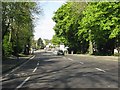
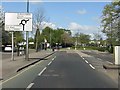
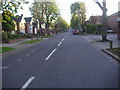
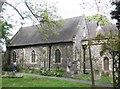
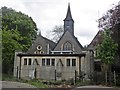
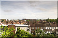
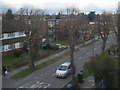
Photos of HA0 2EP


Area Information
HA0 2EP is a compact postcode area in England, covering just 6,172 square metres and home to 1,766 residents. Its population density is exceptionally high at 286,127 people per square kilometre, suggesting a tightly woven community in a small, residential cluster. Daily life here is likely characterised by proximity to amenities and a focus on local interactions. The area’s small size means it is likely integrated with nearby towns, offering access to broader services while maintaining a distinct local identity. With a median age of 47 and a population skewed towards adults aged 30–64, the community is stable and established. The presence of Barham Primary School, rated ‘good’ by Ofsted, indicates a family-friendly environment, while nearby retail hubs like Tesco Sudbury and rail stations such as Sudbury Town Station provide practical connectivity. This area suits those seeking a balance between urban convenience and a cohesive, mature neighbourhood.
- Area Type
- Postcode
- Area Size
- 6172 m²
- Population
- 1766
- Population Density
- 6901 people/km²
HA0 2EP’s property market is characterised by a 45% home ownership rate, indicating that over half of residents rent their homes. This suggests a rental market that may be influenced by local employment opportunities or proximity to larger towns. The predominant accommodation type is houses, which, given the area’s small size and high population density, likely refers to smaller, family-friendly properties or terraced homes. Buyers considering this area should note its limited size, which may restrict property options, but its proximity to transport links and amenities could enhance its appeal. The market may cater more to renters or those seeking investment properties, though the lack of detailed data on property types or prices means potential buyers should explore nearby areas for broader choices.
House Prices in HA0 2EP
Showing 5 properties
| Address | Type | Beds | Baths | Last Sale Price | Last Sale Date | |
|---|---|---|---|---|---|---|
| 642B Harrow Road, Wembley, HA0 2EP | Flat | - | - | - | - | |
| 642A Harrow Road, Wembley, HA0 2EP | Flat | - | - | - | - | |
| 642C Harrow Road, Wembley, HA0 2EP | Flat | - | - | - | - | |
| 642D Harrow Road, Wembley, HA0 2EP | Flat | - | - | - | - | |
| 642E Harrow Road, Wembley, HA0 2EP | Flat | - | - | - | - |
Energy Efficiency in HA0 2EP
HA0 2EP offers a range of amenities within walking or short-driving distance. Retail options include Tesco Sudbury, Iceland Wembley, and Tesco Wembley, catering to everyday shopping needs. The area’s transport links, such as Sudbury & Harrow Road Station and Perivale, provide easy access to broader services. For leisure, the nearby Kew Pier and Little Venice Waterbus Stop offer scenic routes along the Thames. While the data does not specify parks or recreational spaces, the presence of multiple transport and retail hubs suggests a lifestyle focused on convenience and connectivity. Residents can enjoy a mix of urban amenities and proximity to natural waterways, making daily life practical and varied.
Amenities
Schools
The nearest school to HA0 2EP is Barham Primary School, which serves the local community with a ‘good’ Ofsted rating. This indicates a reliable educational option for younger children, though no secondary schools are listed in the data. The presence of a primary school with a positive rating suggests that families with young children may find the area suitable for their needs. However, those requiring secondary education would need to look beyond HA0 2EP, as no further schools are detailed. The school’s rating reflects a standard of teaching and facilities that align with national benchmarks, offering reassurance for parents prioritising quality education.
| Rank | School | Type | Entry gender | Ages |
|---|
Explore more schools in this area
Go to Schools tabDemographics
The demographic profile of HA0 2EP reflects a mature, settled population. With a median age of 47 and the majority of residents aged 30–64, the area is dominated by working-age adults, suggesting a community focused on stability and long-term residence. Home ownership rates are relatively low at 45%, indicating a significant proportion of residents rent their homes. The predominant accommodation type is houses, which, combined with the high population density, implies smaller properties or terraced housing. The Asian community constitutes the largest ethnic group, contributing to the area’s cultural diversity. While specific deprivation data is not provided, the high proportion of older adults and the presence of essential amenities suggest a quality of life that supports both daily needs and community cohesion.
Household Size
Accommodation Type
Tenure
Ethnic Group
Religion
Household Composition
Age
Household Deprivation
NS-SEC
Explore more demographic insights in this area
Go to Demographics tabPlanning
Planning Constraints
- Flood RiskPremium
- Ramsar Wetland SitesPremium
- Area of Outstanding Natural BeautyPremium
- Protected Nature ReservePremium
- Protected WoodlandPremium