Area Overview for HA0 1DE
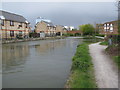
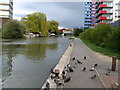
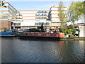
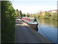
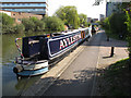
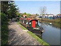
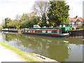
Photos of HA0 1DE

Area Information
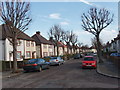
HA0 1DE is a compact residential postcode in England, covering just 1,461 square metres and home to 1,758 residents. Its high population density of 1.2 million people per square kilometre reflects a tightly knit community, where proximity to amenities and transport hubs is a defining feature. The area’s small size means residents share a shared sense of place, with daily life shaped by the surrounding infrastructure. Located near major transport links, it offers easy access to London’s broader networks, while its modest footprint ensures a focused, localised environment. The demographic profile suggests a mature population, with a median age of 47 and a strong presence of adults aged 30–64. This mix of home ownership (64%) and a predominance of houses indicates a stable, established community. For buyers, HA0 1DE presents a blend of practicality and connectivity, though its limited size means availability is constrained. The area’s appeal lies in its balance of residential comfort and access to services, making it a viable choice for those prioritising convenience over expansive living spaces.
- Area Type
- Postcode
- Area Size
- 1461 m²
- Population
- 1758
- Population Density
- 9707 people/km²
HA0 1DE is primarily an owner-occupied area, with 64% of residents purchasing their homes. The accommodation type is predominantly houses, which is unusual for a small postcode but indicates a focus on private, detached living. This suggests the area may cater to families or individuals seeking more space than typical flats or terraced housing. Given the high population density, the limited land area means the housing stock is constrained, with little scope for expansion. Buyers should consider the proximity to amenities and transport links as key selling points, as the area’s small size means properties are likely to be close to services. The dominance of houses may also mean a higher price point compared to rental-focused areas. For those seeking a home in HA0 1DE, the market is likely competitive, with properties prioritising location over size. The mix of home ownership and the focus on houses reflect a community that values stability and long-term residency.
House Prices in HA0 1DE
Showing 6 properties
| Address | Type | Beds | Baths | Last Sale Price | Last Sale Date | |
|---|---|---|---|---|---|---|
| 66 Pleasant Way, Wembley, HA0 1DE | Terraced | 2 | 1 | £410,000 | Jul 2016 | |
| 68 Pleasant Way, Wembley, HA0 1DE | house | 3 | - | £130,000 | May 2001 | |
| 64 Pleasant Way, Wembley, HA0 1DE | Semi-detached | 1 | 2 | £130,000 | Feb 2000 | |
| 66A Pleasant Way, Wembley, HA0 1DE | Terraced | 1 | 1 | - | - | |
| 62 Pleasant Way, Wembley, HA0 1DE | house | - | - | - | - | |
| Annexe, 62 Pleasant Way, Wembley, HA0 1DE | Flat | - | - | - | - |
Energy Efficiency in HA0 1DE
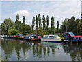
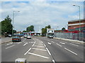
Living in HA0 1DE offers a mix of practical amenities and transport links that shape daily life. The area is within walking distance of five retail outlets, including major supermarkets like Sainsburys Alperton and Asda Alperton, ensuring easy access to groceries and everyday shopping. Metro and rail stations such as Alperton Station and Wembley Central Station provide swift connections to London’s transport network, making commuting straightforward. Ferry access to Kew Pier and Little Venice Waterbus Stop adds a touch of leisure, offering scenic travel options. The presence of multiple transport hubs also facilitates travel to nearby attractions, such as parks or cultural sites. While the area is compact, its proximity to diverse services means residents can enjoy both convenience and connectivity. The blend of retail, transport, and leisure options contributes to a functional lifestyle, though the small size of HA0 1DE means the community is tightly focused on its immediate surroundings.
Amenities
Schools
The nearest school to HA0 1DE is Vicar’s Green Primary School, which holds an outstanding Ofsted rating. This indicates a high standard of education for younger children, which is a significant draw for families. The school’s primary focus means it serves children aged 4–11, but the absence of secondary schools in the data suggests families may need to look further afield for older children’s education. The presence of a top-rated primary school enhances the area’s appeal, particularly for those prioritising quality schooling. However, buyers should consider the need for additional transport or relocation for secondary education. The school’s location within practical reach of residents reinforces the area’s suitability for families, though the lack of further educational institutions nearby may be a consideration for those with older children.
| Rank | School | Type | Entry gender | Ages |
|---|
Explore more schools in this area
Go to Schools tabDemographics
The community in HA0 1DE is predominantly composed of adults aged 30–64, with a median age of 47. This suggests a mature, settled population, likely with established careers and family structures. Home ownership is strong, with 64% of residents owning their properties, compared to 36% renting. The accommodation type is primarily houses, reflecting a preference for private, detached living. The predominant ethnic group is Asian_total, which shapes the area’s cultural character. With a population density of 1.2 million per square kilometre, the area is densely populated, implying a high concentration of households in a small space. This density may influence the local economy and social dynamics, fostering a close-knit environment. However, it also means resources and services are shared among a large number of people, which can impact the availability of amenities. The demographic data highlights a stable, family-oriented community with a clear majority of homebuyers, suggesting long-term investment in the area.
Household Size
Accommodation Type
Tenure
Ethnic Group
Religion
Household Composition
Age
Household Deprivation
NS-SEC
Explore more demographic insights in this area
Go to Demographics tabPlanning
Planning Constraints
- Flood RiskPremium
- Ramsar Wetland SitesPremium
- Area of Outstanding Natural BeautyPremium
- Protected Nature ReservePremium
- Protected WoodlandPremium