Area Overview for Queen's Park
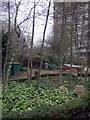
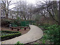
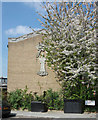
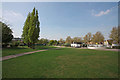
Photos of Queen's Park


Area Information
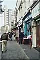
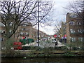
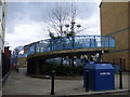
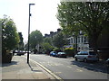
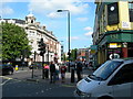
Queen’s Park is a civil parish located in North West London, crossing the boundary between the London Borough of Brent and the City of Westminster. The parish covers 58.4 hectares and holds a population of 2,685 residents. This creates a population density of 4,597 people per square kilometre, reflecting a compact urban living environment. The area is named for the central 30-acre public park laid out in 1886 in the former parish of Willesden. This green space now sits within the parish of Queen’s Park, which was established in 2014 following a resident vote. The park itself borders neighbouring communities like Kilburn, Kensal Town, and Brondesbury. Residential development here dates back to the Victorian era, with significant estates built between 1875 and 1881. Queens Park Rangers football club originated from local teams in this district in 1889. Living in Queen's Park offers close access to central 30-acre green space while remaining part of a historic urban fabric that includes the London Borough of Brent and City of Westminster jurisdictions. The location provides direct access to the London Overground and Bakerloo line services through Queen’s Park station.
- Area Type
- Parish
- Area Size
- 58.4 hectares
- Population
- 2685
- Population Density
- 4597 people/km²
Demographics
The community in Queen's Park displays a distinct demographic profile centred on an older resident base. The median age is 70 years old, indicating a population heavily weighted toward older residents. There is no specific median age data for younger cohorts in the provided records. Home ownership stands at 22 per cent, meaning the vast majority of households reside in rented accommodation. The data does not specify the most common age range beyond the overall total, nor does it detail predominant ethnic groups, religious affiliations, or specific household composition breakdowns. Nevertheless, the high midpoint age suggests a demographic dominated by retirees or seniors. With such a large proportion of the population over seventy, the area likely functions as a retirement hub rather than a vibrant hub for young families or students. The low ownership rate of twenty-two per cent reinforces the idea that rental arrangements form the primary housing vehicle for these residents. When considering homes in Queen's Park, one encounters a market where long-term tenancy is the norm for the majority, which may influence local services and community engagement dynamics. Safety figures show a medium crime risk with a score of sixty-four out of one hundred, suggesting standard precautions apply despite the older resident profile.
Household Size
Accommodation Type
Tenure
Ethnic Group
Religion
Household Composition
Age
Household Deprivation
NS-SEC
Explore more demographic insights in this area
Go to Demographics tabPlanning
Planning Constraints
- Flood RiskPremium
- Ramsar Wetland SitesPremium
- Area of Outstanding Natural BeautyPremium
- Protected Nature ReservePremium
- Protected WoodlandPremium
- Crime RiskPremium