Area Overview for City of Westminster
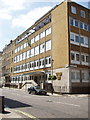
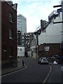
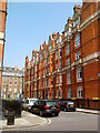
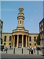
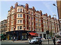
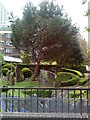
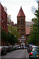
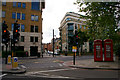
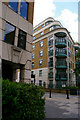
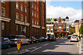
Photos of City of Westminster


Area Information
City of Westminster stands as the political and cultural heart of London, covering 17.8 square kilometres. You will find a population of 112,095 residents living within this dense urban borough. The area encompasses historic districts such as Soho, Paddington, St John's Wood, and St Marylebone, merging centuries-old grandeur with modern activity. Westminster forms the seat of UK Government, sheltering iconic sites like the Palace of Westminster and Westminster Abbey. Local governance evolved from courts like the Court of Burgesses to the modern borough established in 1965. Life here moves at fast times, reflecting its role as the commercial core of the capital. You access major landmarks including Westminster Abbey, a UNESCO World Heritage site, and numerous government buildings. The mix of deep immigration history and diverse communities has shaped a cosmopolitan atmosphere since the 17th century. Living in City of Westminster means being surrounded by history while navigating one of the busiest built-up areas in England. Coordinates approximately 51.5137° N, 0.1607° W place you on Thorney Island, north of the River Thames. The environment presents a character defined by constant movement, cultural significance, and architectural preservation.
- Area Type
- Built Up Area 250
- Area Size
- 17.8 km²
- Population
- 112095
- Population Density
- 6280 people/km²
Residents of City of Westminster benefit from immediate access to extensive retail and transport amenities. The nearest shops include Sainsburys Marble, Tesco Marble, and M&S Marble, covering essential grocery and clothing needs. Transport networks surround you with five metro stations and five rail stations listed as key local assets. Bus services connect directly to London Victoria Coach Station and the Green Line Coach Station. Ferry services operate from Little Venice Waterbus Stop, London Zoo Waterbus Stop, and Embankment Pier. These facilities allow you to commute, travel, or enjoy leisure activities without significant travel time. You can purchase goods at nearby Tesco or M&S with the closest convenience. Dining options are plentiful within the bustling districts, though specific restaurant names are not listed in the provided categories. The character of the area supports a lifestyle centred on culture, history, and urban convenience. Living here means daily encounters with tourists and visitors at landmarks like Westminster Abbey. You will find that practical errands occur easily across the borough, from shopping at Marble Arch to catching trains at Paddington. The abundance of transport nodes ensures you never feel cut off from the wider city.
Amenities
Schools
You have access to five specific educational institutions nearest to City of Westminster, though none appear as state-maintained primary or secondary schools in the provided list. Nearby independent options include Pembridge Hall School, Kensington Park School, Portland Place School, and Brighton College Prep Kensington. Kensington Park School holds an Ofsted rating of good, indicating high standards of education delivery. Brighton College Prep Kensington also carries a good Ofsted rating. These independent institutions serve families seeking private education alternatives within the borough. Tachbrook Nursery School provides early years care for younger children in the vicinity. The presence of these schools suggests a concentration of independent providers rather than state schools in the immediate catalogue of data. If you are considering schools near City of Westminster, local authorities manage state provision, but these independent names represent the specific entities listed. Families living here often supplement state education with independent options like these. The mix of school types offers choices for those prioritising private education pathways over comprehensive state systems. Each institution listed operates independently, providing alternatives to the standard state network. You should verify if additional state schools serve specific catchment zones within the borough limits.
| Rank | School | Type | Entry gender | Ages |
|---|
Explore more schools in this area
Go to Schools tabDemographics
The community in City of Westminster shows a median age of 70 years. This indicates a population skew heavily towards older age groups compared to the national average. Total household composition data reflects this mature demographic profile. You will encounter fewer families with young children relative to other boroughs due to these age statistics. Home ownership levels sit at 28 per cent, meaning just over one quarter of residents own their properties outright. This low percentage suggests a predominantly rental market where many people rent rather than buy. Accommodation type statistics confirm this shift in tenure, with private and social rented sectors hosting the majority of households. Specific data on predominant ethnic groups and religion are not available in the current records, but the character of the area is known to be diverse. You may find that few young professionals or families reside permanently here. The high population density of 6,280 people per square kilometre creates an intense urban environment. Living in City of Westminster requires adaptation to a space designed for permanence and tradition, with a resident base that values stability and leisure.
Household Size
Accommodation Type
Tenure
Ethnic Group
Religion
Household Composition
Age
Household Deprivation
NS-SEC
Explore more demographic insights in this area
Go to Demographics tabPlanning
Planning Constraints
- Crime RiskPremium