Area Overview for EN5 4LU
Photos of EN5 4LU
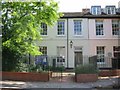
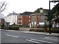
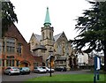
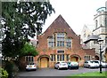
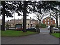
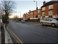
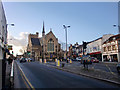
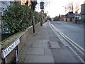
100 photos from this area
Area Information
Key information about the EN5 4LU including its size, population, and administrative classification.
- Area Type
- Postcode
- Area Size
- 4754 m²
- Population
- Not available
- Population Density
- Not available
House Prices in EN5 4LU
29
Properties
£547,500
Average Sold Price
£206,000
Lowest Price
£950,000
Highest Price
Showing 29 properties
| Address | Type | Beds | Baths | Last Sale Price | Last Sale Date | |
|---|---|---|---|---|---|---|
| 30 Carnarvon Road, Barnet, EN5 4LU | Terraced | 3 | 1 | £660,000 | Jun 2025 | |
| 42 Carnarvon Road, Barnet, EN5 4LU | house | 2 | - | £461,500 | Mar 2025 | |
| 26 Carnarvon Road, Barnet, EN5 4LU | Detached | 4 | 2 | £950,000 | Aug 2024 | |
| 34 Carnarvon Road, Barnet, EN5 4LU | house | 3 | 1 | £675,000 | Jun 2021 | |
| 8 Carnarvon Road, Barnet, EN5 4LU | Terraced | 4 | 1 | £845,000 | Jun 2020 | |
| 16 Carnarvon Road, Barnet, EN5 4LU | Terraced | 5 | - | £835,000 | Jan 2020 | |
| 6 Carnarvon Road, Barnet, EN5 4LU | Terraced | 4 | 1 | £740,000 | Oct 2019 | |
| 40 Carnarvon Road, Barnet, EN5 4LU | Detached | 3 | 2 | £550,000 | Oct 2016 | |
| 38 Carnarvon Road, Barnet, EN5 4LU | Terraced | 3 | - | £630,000 | Oct 2015 | |
| 24 Carnarvon Road, Barnet, EN5 4LU | house | 3 | - | £665,000 | Jun 2015 |
Page 1 of 3
Energy Efficiency in EN5 4LU
Amenities
Schools
| Rank | School | Type | Entry gender | Ages |
|---|
Explore more schools in this area
Go to Schools tabDemographics
Household Size
Family (3-5 people)
most common
Accommodation Type
Houses
most common
Tenure
69
majority
Ethnic Group
White
most common
Religion
N/A
most common
Household Composition
N/A
most common
Age
47
median
Adults (30-64 years)
most common
Household Deprivation
N/A
with no deprivation
NS-SEC
53
in Lower managerial occupations
Explore more demographic insights in this area
Go to Demographics tabPlanning
Planning Constraints
- Flood RiskPremium
- Ramsar Wetland SitesPremium
- Area of Outstanding Natural BeautyPremium
- Protected Nature ReservePremium
- Protected WoodlandPremium