Area Overview for EN5 4EU
Photos of EN5 4EU
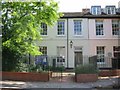
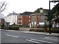
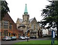
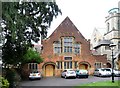
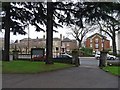
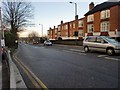
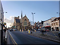
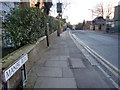
100 photos from this area
Area Information
Key information about the EN5 4EU including its size, population, and administrative classification.
- Area Type
- Postcode
- Area Size
- 4990 m²
- Population
- Not available
- Population Density
- Not available
House Prices in EN5 4EU
32
Properties
£374,600
Average Sold Price
£57,250
Lowest Price
£750,000
Highest Price
Showing 32 properties
| Address | Type | Beds | Baths | Last Sale Price | Last Sale Date | |
|---|---|---|---|---|---|---|
| 21 Alston Road, Barnet, EN5 4EU | Terraced | 3 | 1 | £750,000 | Feb 2018 | |
| 19 Alston Road, Barnet, EN5 4EU | house | 4 | - | £620,000 | Apr 2014 | |
| 34 Alston Road, Barnet, EN5 4EU | Semi-detached | - | - | £665,000 | Aug 2013 | |
| 38 Alston Road, Barnet, EN5 4EU | Semi-detached | - | - | £664,950 | May 2012 | |
| 27 Alston Road, Barnet, EN5 4EU | house | 3 | - | £460,000 | Mar 2012 | |
| 32A Alston Road, Barnet, EN5 4EU | Flat | - | - | £160,000 | Dec 2008 | |
| 17 Alston Road, Barnet, EN5 4EU | Detached | 4 | 2 | £355,000 | Jan 2004 | |
| 36 Alston Road, Barnet, EN5 4EU | Semi-detached | - | - | £312,000 | Oct 2001 | |
| 25 Alston Road, Barnet, EN5 4EU | Semi-detached | - | - | £158,000 | Aug 1999 | |
| 23 Alston Road, Barnet, EN5 4EU | Semi-detached | - | - | £157,000 | Jun 1999 |
Page 1 of 4
Energy Efficiency in EN5 4EU
Amenities
Schools
| Rank | School | Type | Entry gender | Ages |
|---|
Explore more schools in this area
Go to Schools tabDemographics
Household Size
Family (3-5 people)
most common
Accommodation Type
Houses
most common
Tenure
69
majority
Ethnic Group
White
most common
Religion
N/A
most common
Household Composition
N/A
most common
Age
47
median
Adults (30-64 years)
most common
Household Deprivation
N/A
with no deprivation
NS-SEC
53
in Lower managerial occupations
Explore more demographic insights in this area
Go to Demographics tabPlanning
Planning Constraints
- Flood RiskPremium
- Ramsar Wetland SitesPremium
- Area of Outstanding Natural BeautyPremium
- Protected Nature ReservePremium
- Protected WoodlandPremium