Area Overview for EN5 2FH
Photos of EN5 2FH
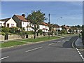
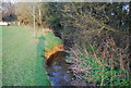
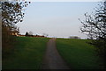
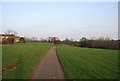
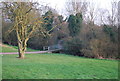
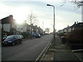
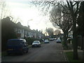
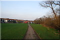
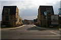
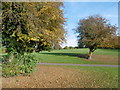
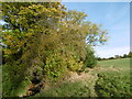
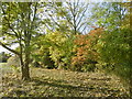
61 photos from this area
Area Information
Key information about the EN5 2FH including its size, population, and administrative classification.
- Area Type
- Postcode
- Area Size
- 6075 m²
- Population
- 1561
- Population Density
- 6254 people/km²
House Prices in EN5 2FH
56
Properties
£644,688
Average Sold Price
£600,000
Lowest Price
£685,000
Highest Price
Showing 56 properties
| Address | Type | Beds | Baths | Last Sale Price | Last Sale Date | |
|---|---|---|---|---|---|---|
| 25 Hera Avenue, Underhill, Barnet, EN5 2FH | house | - | - | £600,000 | Feb 2019 | |
| 27 Hera Avenue, Underhill, Barnet, EN5 2FH | house | - | - | £600,000 | Jan 2019 | |
| 29 Hera Avenue, Underhill, Barnet, EN5 2FH | house | 3 | 1 | £600,000 | Dec 2018 | |
| 23 Hera Avenue, Underhill, Barnet, EN5 2FH | house | - | - | £650,000 | Dec 2018 | |
| 17 Hera Avenue, Underhill, Barnet, EN5 2FH | Terraced | 3 | 3 | £660,000 | Sep 2018 | |
| 9 Hera Avenue, Underhill, Barnet, EN5 2FH | house | - | - | £650,000 | Sep 2018 | |
| 19 Hera Avenue, Underhill, Barnet, EN5 2FH | house | 3 | 3 | £650,000 | Sep 2018 | |
| 21 Hera Avenue, Underhill, Barnet, EN5 2FH | house | - | - | £650,000 | Sep 2018 | |
| 5 Hera Avenue, Underhill, Barnet, EN5 2FH | house | - | - | £680,000 | Sep 2018 | |
| 11 Hera Avenue, Underhill, Barnet, EN5 2FH | house | 3 | 2 | £650,000 | Sep 2018 |
Page 1 of 6
Energy Efficiency in EN5 2FH
Amenities
Schools
| Rank | School | Type | Entry gender | Ages |
|---|
Explore more schools in this area
Go to Schools tabDemographics
Household Size
Family (3-5 people)
most common
Accommodation Type
Houses
most common
Tenure
46
majority
Ethnic Group
White
most common
Religion
N/A
most common
Household Composition
N/A
most common
Age
47
median
Adults (30-64 years)
most common
Household Deprivation
N/A
with no deprivation
NS-SEC
33
in Lower managerial occupations
Explore more demographic insights in this area
Go to Demographics tabPlanning
Planning Constraints
- Flood RiskPremium
- Ramsar Wetland SitesPremium
- Area of Outstanding Natural BeautyPremium
- Protected Nature ReservePremium
- Protected WoodlandPremium