Area Overview for EN4 8UL
Photos of EN4 8UL
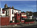
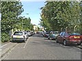
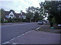
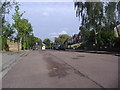
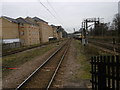
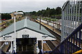
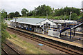
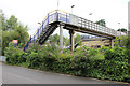
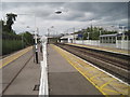
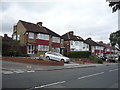
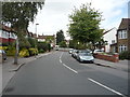
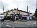
45 photos from this area
Area Information
Key information about the EN4 8UL including its size, population, and administrative classification.
- Area Type
- Postcode
- Area Size
- 1.1 hectares
- Population
- 1759
- Population Density
- 9337 people/km²
House Prices in EN4 8UL
24
Properties
£471,650
Average Sold Price
£152,000
Lowest Price
£708,000
Highest Price
Showing 24 properties
| Address | Type | Beds | Baths | Last Sale Price | Last Sale Date | |
|---|---|---|---|---|---|---|
| 15 Somaford Grove, East Barnet, Barnet, EN4 8UL | Semi-detached | 3 | 1 | £625,000 | Jun 2025 | |
| 3 Somaford Grove, East Barnet, Barnet, EN4 8UL | Semi-detached | 3 | 1 | £665,500 | Sep 2023 | |
| 21 Somaford Grove, East Barnet, Barnet, EN4 8UL | Semi-detached | 3 | 1 | £708,000 | Nov 2022 | |
| 17 Somaford Grove, East Barnet, Barnet, EN4 8UL | Semi-detached | 3 | 1 | £545,000 | Sep 2021 | |
| 2 Somaford Grove, East Barnet, Barnet, EN4 8UL | Semi-detached | 3 | 1 | £520,000 | Mar 2020 | |
| 22 Somaford Grove, East Barnet, Barnet, EN4 8UL | house | 3 | - | £665,000 | Jan 2020 | |
| 24 Somaford Grove, East Barnet, Barnet, EN4 8UL | Semi-detached | 3 | 1 | £650,000 | Apr 2018 | |
| 11 Somaford Grove, East Barnet, Barnet, EN4 8UL | Semi-detached | 5 | 2 | £425,000 | Aug 2013 | |
| 16 Somaford Grove, East Barnet, Barnet, EN4 8UL | house | 3 | - | £306,000 | Oct 2011 | |
| 6 Somaford Grove, East Barnet, Barnet, EN4 8UL | Semi-detached | - | - | £310,000 | Oct 2005 |
Page 1 of 3
Energy Efficiency in EN4 8UL
Amenities
Schools
| Rank | School | Type | Entry gender | Ages |
|---|
Explore more schools in this area
Go to Schools tabDemographics
Household Size
Family (3-5 people)
most common
Accommodation Type
Flats
most common
Tenure
49
majority
Ethnic Group
White
most common
Religion
N/A
most common
Household Composition
N/A
most common
Age
47
median
Adults (30-64 years)
most common
Household Deprivation
N/A
with no deprivation
NS-SEC
35
in Lower managerial occupations
Explore more demographic insights in this area
Go to Demographics tabPlanning
Planning Constraints
- Flood RiskPremium
- Ramsar Wetland SitesPremium
- Area of Outstanding Natural BeautyPremium
- Protected Nature ReservePremium
- Protected WoodlandPremium