Area Overview for EN3 6AJ
Photos of EN3 6AJ
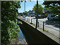
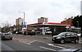
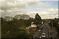
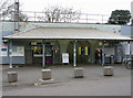
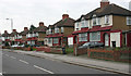
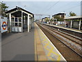
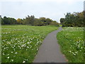
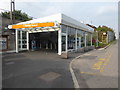
73 photos from this area
Area Information
Key information about the EN3 6AJ including its size, population, and administrative classification.
- Area Type
- Postcode
- Area Size
- 4634 m²
- Population
- 1732
- Population Density
- 15048 people/km²
House Prices in EN3 6AJ
19
Properties
£230,111
Average Sold Price
£117,000
Lowest Price
£450,000
Highest Price
Showing 19 properties
| Address | Type | Beds | Baths | Last Sale Price | Last Sale Date | |
|---|---|---|---|---|---|---|
| 71 Beaconsfield Road, Enfield, EN3 6AJ | Terraced | 3 | 1 | £365,000 | Dec 2023 | |
| 65 Beaconsfield Road, Enfield, EN3 6AJ | Terraced | 4 | 2 | £450,000 | Mar 2016 | |
| 69 Beaconsfield Road, Enfield, EN3 6AJ | Terraced | 3 | - | £246,000 | Jun 2012 | |
| 83 Beaconsfield Road, Enfield, EN3 6AJ | Terraced | 3 | 1 | £237,000 | Sep 2007 | |
| 77 Beaconsfield Road, Enfield, EN3 6AJ | house | - | - | £184,500 | Sep 2004 | |
| 55 Beaconsfield Road, Enfield, EN3 6AJ | Terraced | 3 | 2 | £145,000 | Aug 2003 | |
| 75 Beaconsfield Road, Enfield, EN3 6AJ | house | - | - | £200,000 | Jul 2003 | |
| 57 Beaconsfield Road, Enfield, EN3 6AJ | Terraced | 3 | 1 | £117,000 | Jan 2002 | |
| 61 Beaconsfield Road, Enfield, EN3 6AJ | house | - | - | £126,500 | Sep 2001 | |
| 53 Beaconsfield Road, Enfield, EN3 6AJ | Terraced | - | - | - | - |
Page 1 of 2
Energy Efficiency in EN3 6AJ
Amenities
Schools
| Rank | School | Type | Entry gender | Ages |
|---|
Explore more schools in this area
Go to Schools tabDemographics
Household Size
Family (3-5 people)
most common
Accommodation Type
Flats
most common
Tenure
28
majority
Ethnic Group
White
most common
Religion
N/A
most common
Household Composition
N/A
most common
Age
47
median
Adults (30-64 years)
most common
Household Deprivation
N/A
with no deprivation
NS-SEC
14
in Lower managerial occupations
Explore more demographic insights in this area
Go to Demographics tabPlanning
Planning Constraints
- Flood RiskPremium
- Ramsar Wetland SitesPremium
- Area of Outstanding Natural BeautyPremium
- Protected Nature ReservePremium
- Protected WoodlandPremium