Area Overview for EN2 8DH
Photos of EN2 8DH
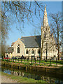
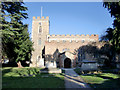
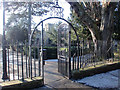
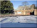
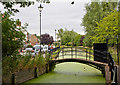


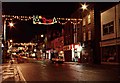
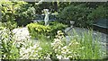
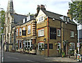
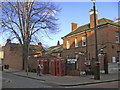
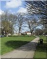
100 photos from this area
Area Information
Key information about the EN2 8DH including its size, population, and administrative classification.
- Area Type
- Postcode
- Area Size
- 1.1 hectares
- Population
- 1653
- Population Density
- 6596 people/km²
House Prices in EN2 8DH
32
Properties
£532,287
Average Sold Price
£150,000
Lowest Price
£900,000
Highest Price
Showing 32 properties
| Address | Type | Beds | Baths | Last Sale Price | Last Sale Date | |
|---|---|---|---|---|---|---|
| 9 Chase Court Gardens, Enfield, EN2 8DH | Detached | 4 | 2 | £840,000 | Oct 2024 | |
| 7 Chase Court Gardens, Enfield, EN2 8DH | Semi-detached | 4 | 1 | £900,000 | Jan 2023 | |
| 32 Chase Court Gardens, Enfield, EN2 8DH | Retail | 4 | 2 | £805,000 | Sep 2022 | |
| 12A Chase Court Gardens, Enfield, EN2 8DH | Flat | - | - | £290,000 | May 2021 | |
| 6 Chase Court Gardens, Enfield, EN2 8DH | house | 3 | - | £670,000 | Nov 2020 | |
| 20 Chase Court Gardens, Enfield, EN2 8DH | Semi-detached | 3 | 1 | £685,000 | Sep 2020 | |
| 30 Chase Court Gardens, Enfield, EN2 8DH | Semi-detached | 3 | 1 | £635,000 | Jun 2020 | |
| 15 Chase Court Gardens, Enfield, EN2 8DH | Detached | 4 | 2 | £852,000 | Aug 2018 | |
| 4 Chase Court Gardens, Enfield, EN2 8DH | Semi-detached | 4 | 1 | £710,000 | Sep 2017 | |
| 18 Chase Court Gardens, Enfield, EN2 8DH | Semi-detached | 4 | 1 | £687,500 | Jun 2017 |
Page 1 of 4
Energy Efficiency in EN2 8DH
Amenities
Schools
| Rank | School | Type | Entry gender | Ages |
|---|
Explore more schools in this area
Go to Schools tabDemographics
Household Size
Two person
most common
Accommodation Type
Houses
most common
Tenure
66
majority
Ethnic Group
White
most common
Religion
N/A
most common
Household Composition
N/A
most common
Age
47
median
Adults (30-64 years)
most common
Household Deprivation
N/A
with no deprivation
NS-SEC
46
in Lower managerial occupations
Explore more demographic insights in this area
Go to Demographics tabPlanning
Planning Constraints
- Flood RiskPremium
- Ramsar Wetland SitesPremium
- Area of Outstanding Natural BeautyPremium
- Protected Nature ReservePremium
- Protected WoodlandPremium