Area Overview for EN2 7NY
Photos of EN2 7NY
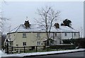
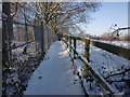
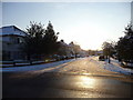
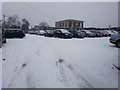
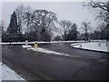
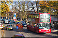
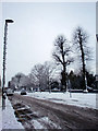
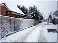
100 photos from this area
Area Information
Key information about the EN2 7NY including its size, population, and administrative classification.
- Area Type
- Postcode
- Area Size
- 1.0 hectares
- Population
- 1803
- Population Density
- 5341 people/km²
House Prices in EN2 7NY
20
Properties
£564,447
Average Sold Price
£133,000
Lowest Price
£1,075,000
Highest Price
Showing 20 properties
| Address | Type | Beds | Baths | Last Sale Price | Last Sale Date | |
|---|---|---|---|---|---|---|
| 47 Merryhills Drive, Enfield, EN2 7NY | house | - | - | £832,920 | Sep 2022 | |
| 61 Merryhills Drive, Enfield, EN2 7NY | house | - | - | £1,075,000 | Jun 2021 | |
| 43 Merryhills Drive, Enfield, EN2 7NY | house | - | - | £820,000 | Feb 2021 | |
| 58 Merryhills Drive, Enfield, EN2 7NY | Semi-detached | 3 | - | £630,000 | Nov 2020 | |
| 50 Merryhills Drive, Enfield, EN2 7NY | Semi-detached | 3 | 1 | £670,000 | Aug 2019 | |
| 55 Merryhills Drive, Enfield, EN2 7NY | Semi-detached | 3 | 1 | £707,000 | Jul 2017 | |
| 51 Merryhills Drive, Enfield, EN2 7NY | Semi-detached | - | - | £600,000 | Jul 2016 | |
| 54 Merryhills Drive, Enfield, EN2 7NY | Semi-detached | - | - | £385,000 | Oct 2006 | |
| 39 Merryhills Drive, Enfield, EN2 7NY | Detached | - | - | £177,000 | Jan 1998 | |
| 59 Merryhills Drive, Enfield, EN2 7NY | Semi-detached | - | - | £179,000 | Nov 1997 |
Page 1 of 2
Energy Efficiency in EN2 7NY
Amenities
Schools
| Rank | School | Type | Entry gender | Ages |
|---|
Explore more schools in this area
Go to Schools tabDemographics
Household Size
Family (3-5 people)
most common
Accommodation Type
Houses
most common
Tenure
88
majority
Ethnic Group
White
most common
Religion
N/A
most common
Household Composition
N/A
most common
Age
47
median
Adults (30-64 years)
most common
Household Deprivation
N/A
with no deprivation
NS-SEC
45
in Lower managerial occupations
Explore more demographic insights in this area
Go to Demographics tabPlanning
Planning Constraints
- Flood RiskPremium
- Ramsar Wetland SitesPremium
- Area of Outstanding Natural BeautyPremium
- Protected Nature ReservePremium
- Protected WoodlandPremium