Area Overview for EN2 7AP
Photos of EN2 7AP

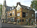
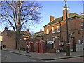
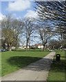
100 photos from this area
Area Information
Key information about the EN2 7AP including its size, population, and administrative classification.
- Area Type
- Postcode
- Area Size
- 5280 m²
- Population
- Not available
- Population Density
- Not available
House Prices in EN2 7AP
22
Properties
£409,400
Average Sold Price
£205,000
Lowest Price
£650,000
Highest Price
Showing 22 properties
| Address | Type | Beds | Baths | Last Sale Price | Last Sale Date | |
|---|---|---|---|---|---|---|
| 21 Gresham Close, Enfield, EN2 7AP | Terraced | 4 | 3 | £650,000 | Mar 2025 | |
| 34 Gresham Close, Enfield, EN2 7AP | house | 3 | - | £650,000 | Jan 2022 | |
| 48 Gresham Close, Enfield, EN2 7AP | Terraced | 2 | 2 | £567,000 | Sep 2021 | |
| 23 Gresham Close, Enfield, EN2 7AP | Terraced | 5 | 2 | £625,000 | Jun 2021 | |
| 42 Gresham Close, Enfield, EN2 7AP | Terraced | 3 | 1 | £590,000 | Nov 2018 | |
| 33 Gresham Close, Enfield, EN2 7AP | Terraced | 4 | 1 | £570,000 | Feb 2017 | |
| 39 Gresham Close, Enfield, EN2 7AP | house | - | - | £370,000 | Oct 2010 | |
| 36 Gresham Close, Enfield, EN2 7AP | house | - | - | £250,000 | Jun 2009 | |
| 29 Gresham Close, Enfield, EN2 7AP | Terraced | - | - | £285,000 | Sep 2006 | |
| 30 Gresham Close, Enfield, EN2 7AP | Terraced | - | - | £240,000 | Feb 2004 |
Page 1 of 3
Energy Efficiency in EN2 7AP
Amenities
Schools
| Rank | School | Type | Entry gender | Ages |
|---|
Explore more schools in this area
Go to Schools tabDemographics
Household Size
One person
most common
Accommodation Type
Flats
most common
Tenure
65
majority
Ethnic Group
White
most common
Religion
N/A
most common
Household Composition
N/A
most common
Age
47
median
Adults (30-64 years)
most common
Household Deprivation
N/A
with no deprivation
NS-SEC
47
in Lower managerial occupations
Explore more demographic insights in this area
Go to Demographics tabPlanning
Planning Constraints
- Flood RiskPremium
- Ramsar Wetland SitesPremium
- Area of Outstanding Natural BeautyPremium
- Protected Nature ReservePremium
- Protected WoodlandPremium