Area Overview for EN2 7EL
Photos of EN2 7EL


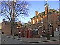
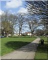
100 photos from this area
Area Information
Key information about the EN2 7EL including its size, population, and administrative classification.
- Area Type
- Postcode
- Area Size
- 1.8 hectares
- Population
- Not available
- Population Density
- Not available
House Prices in EN2 7EL
82
Properties
£209,456
Average Sold Price
£30,000
Lowest Price
£605,000
Highest Price
Showing 82 properties
| Address | Type | Beds | Baths | Last Sale Price | Last Sale Date | |
|---|---|---|---|---|---|---|
| 87 Gladbeck Way, Enfield, EN2 7EL | Flat | 1 | 1 | £270,000 | Jun 2024 | |
| 21 Gladbeck Way, Enfield, EN2 7EL | Terraced | 3 | 1 | £605,000 | May 2024 | |
| 52 Gladbeck Way, Enfield, EN2 7EL | Flat | 2 | 1 | £310,000 | May 2022 | |
| 10 Gladbeck Way, Enfield, EN2 7EL | Flat | 1 | 1 | £265,000 | Mar 2022 | |
| 77 Gladbeck Way, Enfield, EN2 7EL | Flat | - | - | £257,000 | Aug 2021 | |
| 33 Gladbeck Way, Enfield, EN2 7EL | house | - | - | £557,500 | May 2021 | |
| 65 Gladbeck Way, Enfield, EN2 7EL | Flat | 1 | 1 | £265,000 | Apr 2021 | |
| 53 Gladbeck Way, Enfield, EN2 7EL | Flat | 2 | 1 | £285,000 | Mar 2021 | |
| 48 Gladbeck Way, Enfield, EN2 7EL | Flat | 1 | 1 | £235,000 | Mar 2021 | |
| 46 Gladbeck Way, Enfield, EN2 7EL | Flat | - | - | £245,000 | Feb 2020 |
Page 1 of 9
Energy Efficiency in EN2 7EL
Amenities
Schools
| Rank | School | Type | Entry gender | Ages |
|---|
Explore more schools in this area
Go to Schools tabDemographics
Household Size
One person
most common
Accommodation Type
Flats
most common
Tenure
65
majority
Ethnic Group
White
most common
Religion
N/A
most common
Household Composition
N/A
most common
Age
47
median
Adults (30-64 years)
most common
Household Deprivation
N/A
with no deprivation
NS-SEC
47
in Lower managerial occupations
Explore more demographic insights in this area
Go to Demographics tabPlanning
Planning Constraints
- Flood RiskPremium
- Ramsar Wetland SitesPremium
- Area of Outstanding Natural BeautyPremium
- Protected Nature ReservePremium
- Protected WoodlandPremium