Area Overview for EN1 1EQ
Photos of EN1 1EQ
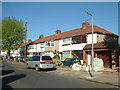
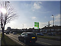
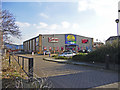
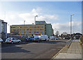
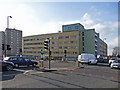
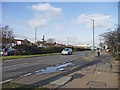
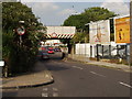
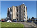
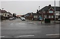
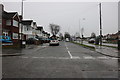
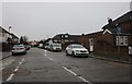
33 photos from this area
Area Information
Key information about the EN1 1EQ including its size, population, and administrative classification.
- Area Type
- Postcode
- Area Size
- 3205 m²
- Population
- 2047
- Population Density
- 15807 people/km²
House Prices in EN1 1EQ
25
Properties
£200,781
Average Sold Price
£53,000
Lowest Price
£300,000
Highest Price
Showing 25 properties
| Address | Type | Beds | Baths | Last Sale Price | Last Sale Date | |
|---|---|---|---|---|---|---|
| 22 Roman Way, Enfield, EN1 1EQ | Flat | 3 | 2 | £240,000 | Aug 2025 | |
| 10 Roman Way, Enfield, EN1 1EQ | Flat | 3 | 1 | £300,000 | Jan 2022 | |
| 44 Roman Way, Enfield, EN1 1EQ | Flat | 2 | 1 | £250,000 | Jun 2021 | |
| 8 Roman Way, Enfield, EN1 1EQ | Maisonette | - | - | £250,000 | Sep 2020 | |
| 34 Roman Way, Enfield, EN1 1EQ | Maisonette | - | - | £290,000 | Mar 2019 | |
| 26 Roman Way, Enfield, EN1 1EQ | Flat | 3 | 1 | £260,000 | Apr 2016 | |
| 14 Roman Way, Enfield, EN1 1EQ | Maisonette | 3 | - | £242,099 | Jan 2015 | |
| 2 Roman Way, Enfield, EN1 1EQ | Flat | 3 | - | £158,500 | Dec 2005 | |
| 16 Roman Way, Enfield, EN1 1EQ | Flat | - | - | £93,000 | Sep 2001 | |
| 20 Roman Way, Enfield, EN1 1EQ | Maisonette | - | - | £71,995 | Oct 1999 |
Page 1 of 3
Energy Efficiency in EN1 1EQ
Amenities
Schools
| Rank | School | Type | Entry gender | Ages |
|---|
Explore more schools in this area
Go to Schools tabDemographics
Household Size
Family (3-5 people)
most common
Accommodation Type
Flats
most common
Tenure
29
majority
Ethnic Group
White
most common
Religion
N/A
most common
Household Composition
N/A
most common
Age
47
median
Adults (30-64 years)
most common
Household Deprivation
N/A
with no deprivation
NS-SEC
21
in Lower managerial occupations
Explore more demographic insights in this area
Go to Demographics tabPlanning
Planning Constraints
- Flood RiskPremium
- Ramsar Wetland SitesPremium
- Area of Outstanding Natural BeautyPremium
- Protected Nature ReservePremium
- Protected WoodlandPremium