Area Overview for E6 3SD
Photos of E6 3SD


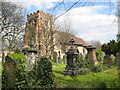
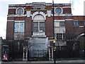
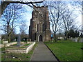
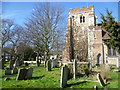
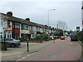
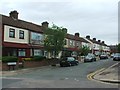
67 photos from this area
Area Information
Key information about the E6 3SD including its size, population, and administrative classification.
- Area Type
- Postcode
- Area Size
- 7733 m²
- Population
- 2022
- Population Density
- 12559 people/km²
House Prices in E6 3SD
35
Properties
£207,029
Average Sold Price
£28,774
Lowest Price
£470,000
Highest Price
Showing 35 properties
| Address | Type | Beds | Baths | Last Sale Price | Last Sale Date | |
|---|---|---|---|---|---|---|
| 29 Stokes Road, East Ham, London, E6 3SD | Terraced | 3 | 1 | £470,000 | Aug 2023 | |
| 21 Stokes Road, East Ham, London, E6 3SD | house | 3 | 2 | £447,500 | Dec 2022 | |
| 1 Stokes Road, East Ham, London, E6 3SD | Terraced | 2 | - | £300,000 | Dec 2022 | |
| 5 Stokes Road, East Ham, London, E6 3SD | house | 3 | 1 | £300,000 | Jun 2022 | |
| 3 Stokes Road, East Ham, London, E6 3SD | Terraced | 3 | 1 | £200,000 | Aug 2020 | |
| 15 Stokes Road, East Ham, London, E6 3SD | house | - | - | £390,000 | Feb 2018 | |
| 7 Stokes Road, East Ham, London, E6 3SD | Terraced | 3 | 1 | £285,000 | Sep 2015 | |
| 55 Stokes Road, East Ham, London, E6 3SD | house | - | - | £250,000 | Jan 2015 | |
| 45 Stokes Road, East Ham, London, E6 3SD | Terraced | 3 | 1 | £180,000 | Dec 2011 | |
| 23 Stokes Road, East Ham, London, E6 3SD | house | - | - | £183,000 | Sep 2011 |
Page 1 of 4
Energy Efficiency in E6 3SD
Amenities
Schools
| Rank | School | Type | Entry gender | Ages |
|---|
Explore more schools in this area
Go to Schools tabDemographics
Household Size
Family (3-5 people)
most common
Accommodation Type
Houses
most common
Tenure
52
majority
Ethnic Group
asian_total
most common
Religion
N/A
most common
Household Composition
N/A
most common
Age
47
median
Adults (30-64 years)
most common
Household Deprivation
N/A
with no deprivation
NS-SEC
20
in Lower managerial occupations
Explore more demographic insights in this area
Go to Demographics tabPlanning
Planning Constraints
- Flood RiskPremium
- Ramsar Wetland SitesPremium
- Area of Outstanding Natural BeautyPremium
- Protected Nature ReservePremium
- Protected WoodlandPremium