Area Overview for E5 9QJ
Photos of E5 9QJ

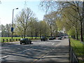

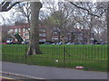
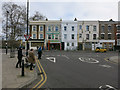

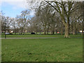

100 photos from this area
Area Information
Key information about the E5 9QJ including its size, population, and administrative classification.
- Area Type
- Postcode
- Area Size
- 1.1 hectares
- Population
- 1933
- Population Density
- 11033 people/km²
House Prices in E5 9QJ
67
Properties
£555,974
Average Sold Price
£57,500
Lowest Price
£1,650,000
Highest Price
Showing 67 properties
| Address | Type | Beds | Baths | Last Sale Price | Last Sale Date | |
|---|---|---|---|---|---|---|
| 45 Cotesbach Road, Hackney, London, E5 9QJ | Detached | 4 | 3 | £1,650,000 | Mar 2025 | |
| 20 Cotesbach Road, Hackney, London, E5 9QJ | Terraced | 3 | 1 | £1,250,000 | May 2024 | |
| 27 Cotesbach Road, Hackney, London, E5 9QJ | Retail | 3 | 1 | £1,040,000 | Sep 2022 | |
| 21 Cotesbach Road, Hackney, London, E5 9QJ | Retail | 3 | 1 | £1,255,000 | Jun 2022 | |
| 52 Cotesbach Road, Hackney, London, E5 9QJ | Terraced | - | - | £1,325,000 | Apr 2018 | |
| House Excluding Basement, 9 Cotesbach Road, Hackney, London, E5 9QJ | Flat | - | - | £580,000 | Apr 2015 | |
| 33 Cotesbach Road, Hackney, London, E5 9QJ | house | 5 | - | £890,000 | Apr 2014 | |
| 43 Cotesbach Road, Hackney, London, E5 9QJ | Terraced | 3 | - | £640,000 | Mar 2013 | |
| 38 Cotesbach Road, Hackney, London, E5 9QJ | house | 3 | - | £680,000 | Sep 2012 | |
| 8 Cotesbach Road, Hackney, London, E5 9QJ | Semi-detached | 3 | - | £525,000 | May 2012 |
Page 1 of 7
Energy Efficiency in E5 9QJ
Amenities
Schools
| Rank | School | Type | Entry gender | Ages |
|---|
Explore more schools in this area
Go to Schools tabDemographics
Household Size
Family (3-5 people)
most common
Accommodation Type
Houses
most common
Tenure
44
majority
Ethnic Group
White
most common
Religion
N/A
most common
Household Composition
N/A
most common
Age
47
median
Adults (30-64 years)
most common
Household Deprivation
N/A
with no deprivation
NS-SEC
40
in Lower managerial occupations
Explore more demographic insights in this area
Go to Demographics tabPlanning
Planning Constraints
- Flood RiskPremium
- Ramsar Wetland SitesPremium
- Area of Outstanding Natural BeautyPremium
- Protected Nature ReservePremium
- Protected WoodlandPremium