Area Overview for E5 0QG
Photos of E5 0QG
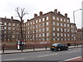
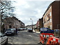
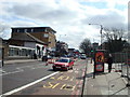
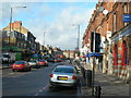


100 photos from this area
Area Information
Key information about the E5 0QG including its size, population, and administrative classification.
- Area Type
- Postcode
- Area Size
- 1.0 hectares
- Population
- 1933
- Population Density
- 11033 people/km²
House Prices in E5 0QG
74
Properties
£780,579
Average Sold Price
£64,274
Lowest Price
£1,445,000
Highest Price
Showing 74 properties
| Address | Type | Beds | Baths | Last Sale Price | Last Sale Date | |
|---|---|---|---|---|---|---|
| 49 Thistlewaite Road, Hackney, London, E5 0QG | Terraced | 4 | - | £1,300,000 | Mar 2019 | |
| Flat B, 3 Thistlewaite Road, Hackney, London, E5 0QG | Flat | 2 | 1 | £560,000 | Feb 2019 | |
| 51 Thistlewaite Road, Hackney, London, E5 0QG | house | - | - | £1,400,000 | Nov 2017 | |
| 15 Thistlewaite Road, Hackney, London, E5 0QG | Terraced | 5 | 2 | £1,445,000 | Jan 2017 | |
| 55 Thistlewaite Road, Hackney, London, E5 0QG | house | - | - | £595,757 | Jun 2011 | |
| 53 Thistlewaite Road, Hackney, London, E5 0QG | house | - | - | £642,000 | Sep 2010 | |
| Flat C, 19 Thistlewaite Road, Hackney, London, E5 0QG | Flat | 1 | 1 | £237,600 | Dec 2007 | |
| 21 Thistlewaite Road, Hackney, London, E5 0QG | Terraced | 5 | 3 | £64,274 | Sep 1998 | |
| Flat B, 1 Thistlewaite Road, Hackney, London, E5 0QG | Flat | 2 | 1 | - | - | |
| 35 Thistlewaite Road, Hackney, London, E5 0QG | Terraced | 7 | 3 | - | - |
Page 1 of 8
Energy Efficiency in E5 0QG
Amenities
Schools
| Rank | School | Type | Entry gender | Ages |
|---|
Explore more schools in this area
Go to Schools tabDemographics
Household Size
Family (3-5 people)
most common
Accommodation Type
Houses
most common
Tenure
44
majority
Ethnic Group
White
most common
Religion
N/A
most common
Household Composition
N/A
most common
Age
47
median
Adults (30-64 years)
most common
Household Deprivation
N/A
with no deprivation
NS-SEC
40
in Lower managerial occupations
Explore more demographic insights in this area
Go to Demographics tabPlanning
Planning Constraints
- Flood RiskPremium
- Ramsar Wetland SitesPremium
- Area of Outstanding Natural BeautyPremium
- Protected Nature ReservePremium
- Protected WoodlandPremium