Area Overview for E3 5BW
Photos of E3 5BW
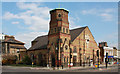
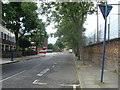
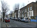
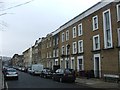
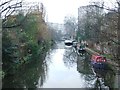
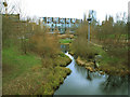
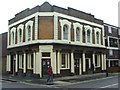
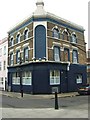
100 photos from this area
Area Information
Key information about the E3 5BW including its size, population, and administrative classification.
- Area Type
- Postcode
- Area Size
- 4971 m²
- Population
- 1947
- Population Density
- 15343 people/km²
House Prices in E3 5BW
25
Properties
£667,222
Average Sold Price
£165,000
Lowest Price
£1,100,000
Highest Price
Showing 25 properties
| Address | Type | Beds | Baths | Last Sale Price | Last Sale Date | |
|---|---|---|---|---|---|---|
| 141 Antill Road, London, E3 5BW | Terraced | 3 | 2 | £850,000 | Mar 2021 | |
| 107 Antill Road, London, E3 5BW | Terraced | 4 | 3 | £1,100,000 | Feb 2021 | |
| 97 Antill Road, London, E3 5BW | Semi-detached | 3 | - | £1,030,000 | Jun 2017 | |
| 93 Antill Road, London, E3 5BW | Terraced | 3 | 1 | £900,000 | Mar 2015 | |
| 131 Antill Road, London, E3 5BW | Terraced | 5 | 2 | £820,000 | Nov 2014 | |
| 135A Antill Road, London, E3 5BW | Terraced | 2 | 1 | £450,000 | Nov 2013 | |
| 99 Antill Road, London, E3 5BW | Terraced | 3 | 1 | £415,000 | May 2006 | |
| 103 Antill Road, London, E3 5BW | Terraced | 4 | 3 | £275,000 | Apr 2001 | |
| 129 Antill Road, London, E3 5BW | house | 3 | - | £165,000 | Jul 1999 | |
| 139 Antill Road, London, E3 5BW | Terraced | 3 | 1 | - | - |
Page 1 of 3
Energy Efficiency in E3 5BW
Amenities
Schools
| Rank | School | Type | Entry gender | Ages |
|---|
Explore more schools in this area
Go to Schools tabDemographics
Household Size
Family (3-5 people)
most common
Accommodation Type
Houses
most common
Tenure
39
majority
Ethnic Group
White
most common
Religion
N/A
most common
Household Composition
N/A
most common
Age
47
median
Adults (30-64 years)
most common
Household Deprivation
N/A
with no deprivation
NS-SEC
49
in Lower managerial occupations
Explore more demographic insights in this area
Go to Demographics tabPlanning
Planning Constraints
- Flood RiskPremium
- Ramsar Wetland SitesPremium
- Area of Outstanding Natural BeautyPremium
- Protected Nature ReservePremium
- Protected WoodlandPremium